The Benefits Of Aerial Photography
- ARO Aerial Inc.
Categories: Aerial 3D Mapping , Aerial Photographers , Aerial Photography , Aerial Roof Inspection , Aerial Surveys , Aerial Videos , Drone Inspection Services , Drone Photographer , Drone Photography , Drone Photography Company , Drone Service Provider , Drone Services Drone Photographer , Drone Videography
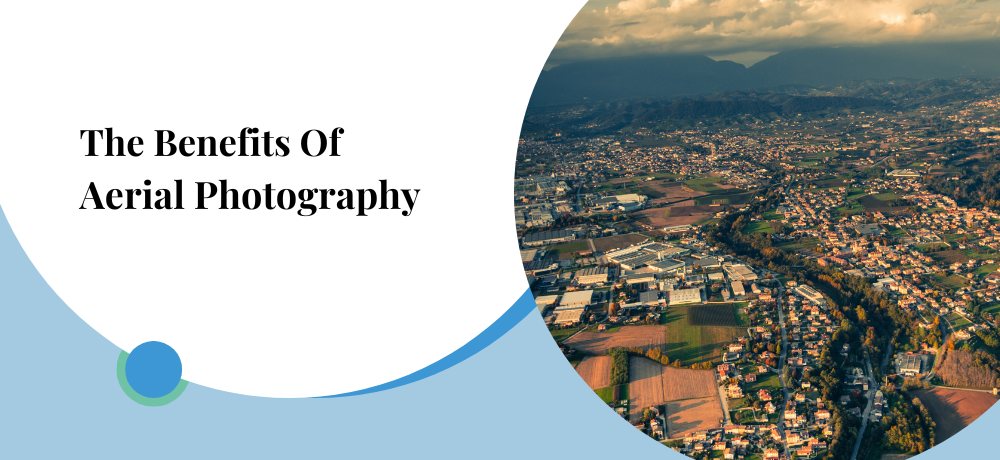
Have you ever wondered what the world looks like from above? Aerial photography can give you that bird's-eye view and capture breathtaking images that can't be seen from the ground. With the rise of drones and other aerial technology, this practice has become more accessible and popular than ever before. From environmental monitoring to real estate and tourism, aerial photography has countless applications that can benefit a variety of industries. By providing a unique perspective and valuable insights, aerial photography has become an essential tool for understanding and appreciating the world around us.
In this blog post, ARO Aerial Inc. is going to discuss a few key benefits of aerial photography.
1. Comprehensive and accurate mapping
Aerial photography is a game-changer for industries like urban planning, environmental monitoring, and natural resource management because it allows for highly-detailed and accurate images of large areas of land. By giving us a unique bird's-eye view, aerial photography offers a fresh perspective that can help us make more informed decisions about how to use the land. With the resulting high-quality images and data, we can allocate resources more efficiently, plan more sustainable developments, and better protect natural areas. It's truly amazing what a new perspective from up high can do for us!
2. Improved visualization
The beauty of aerial photography is that it captures a perspective that simply can't be achieved from the ground. By showcasing landscapes and structures from above, aerial photography allows for a better visualization that can be highly valuable for a variety of purposes. Whether it's for real estate marketing, tourism promotion, or outdoor recreation planning, the unique perspective provided by aerial photography can help to capture the attention of viewers and bring new insights to the table.
3. Cost-effective
Aerial photography is often a more cost-effective alternative to traditional ground-based photography since it enables the capture of vast areas in just one flight. This can translate to significant time and cost savings across a variety of applications, including infrastructure inspection and land surveying. By avoiding the need for multiple ground-based shots, aerial photography offers a more efficient solution that can help streamline processes and lower overall expenses. When it comes to capturing comprehensive and high-quality images, the sky's the limit!
4. Access to hard-to-reach areas
The versatility of aerial photography is unmatched when it comes to capturing images of areas that are hard to access from the ground. These areas may include rugged terrains, remote islands, or dense forests, among others. As such, aerial photography has become an invaluable tool for many different purposes, including scientific research, conservation, and resource management. The unique bird's-eye view that aerial photography provides helps us appreciate and understand the natural world in a way that's not possible from the ground. It's truly awe-inspiring to think of the countless opportunities that arise when we can capture the beauty of these remote landscapes and environments from above.
5. Time-saving
With the ability to quickly capture high-quality images of large areas, aerial photography is a game-changer in time-sensitive situations like emergencies or construction projects. Its unique perspective can help us save time and resources, making it an efficient solution for many industries. From a bird's-eye view, we can optimize our operations and get the job done with ease. In short, aerial photography is a valuable time-saving tool that shouldn't be overlooked.
6. Historical documentation
Aerial photography can provide a unique historical record of landscapes and structures over time. This can be useful for research, documentation, and preservation efforts, such as in archaeology and architectural history.
Aerial photography has become an essential tool in many industries due to its numerous benefits. From providing comprehensive and accurate mapping to improving visualization and access to hard-to-reach areas, aerial photography has revolutionized the way we gather and analyze information. It is cost-effective, time-saving, and can even provide a historical record of landscapes and structures over time. With advancements in technology, such as drones and high-resolution cameras, aerial photography is becoming increasingly accessible to a wide range of applications. As such, it is likely to remain an important tool for many industries in the years to come.
If you’re looking for professional aerial photography and drone services in Columbus Ohio, reach out to my company ARO Aerial Inc. I am a professional drone pilot and aerial photographer offering drone services. I also provide drone inspection services, aerial surveys, drone mapping, drone 3D modeling, and much more!
Get in touch with me today!
To learn more about the services I offer please click here. To contact me click here or call me at (419) 982-8492.