
Measure your site from your desk
We fly a grid over the site and process the photos into one measured map, a terrain surface and a 3D model. Measure distances, areas and volumes, overlay your plans, and compare this month with last month without walking the site.
Site maps from $1,650
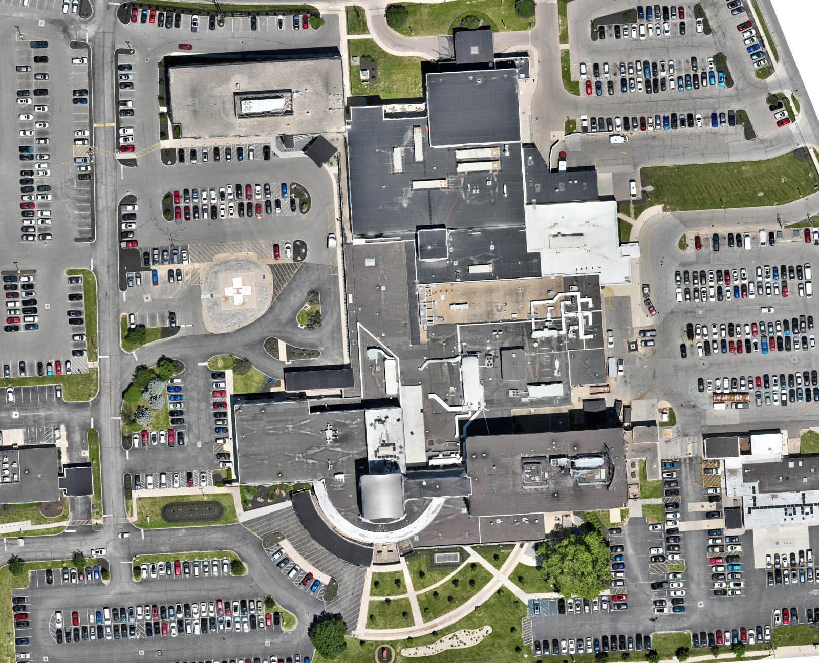
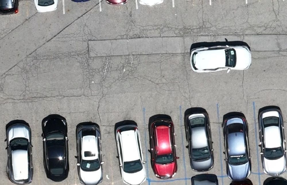
Every pixel has a position
An aerial photo is taken at an angle, so distances in it are distorted. An orthomosaic is corrected so the scale is the same everywhere. One pixel covers a known patch of ground and sits at real coordinates, so you can measure on it and lay your drawings over it.
The same flight produces a surface model, which gives you elevations, volumes and cross-sections. The 3D mesh gives owners and design teams a model of the site they can turn around and inspect.
How accurate? With RTK positioning and ground control points from your surveyor, we check the map against independent checkpoints and report the result in the delivery notes. You see the measured error, not a promise.
One flight, a full set of files
| Deliverable | Format | Used for |
|---|---|---|
| Orthomosaic map | GeoTIFF, JPEG/PDF overview | Base map, plan overlay, condition record |
| Surface model (DSM) | GeoTIFF | Elevations, drainage review, site analysis |
| Contours | DWG, SHP | Preliminary grading and design context |
| 3D textured model | OBJ, GLB, hosted viewer link | Stakeholder review, design context, marketing |
| Point cloud | LAS/LAZ | Civil 3D, Revit and Navisworks workflows |
| Volumes & measurements | PDF report, CSV | Stockpiles, cut/fill, quantity checks |
Twenty maps in two days for a hospital parking study
A Columbus hospital needed to know how full its main campus lots and shuttle lot were across a full day. We mapped both lots at five set times on two days, and every map lined up with the others.
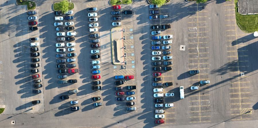
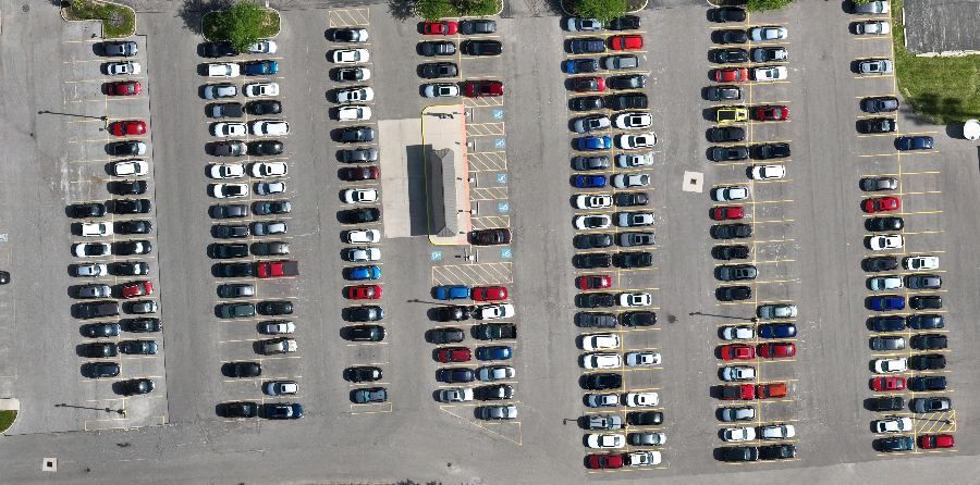
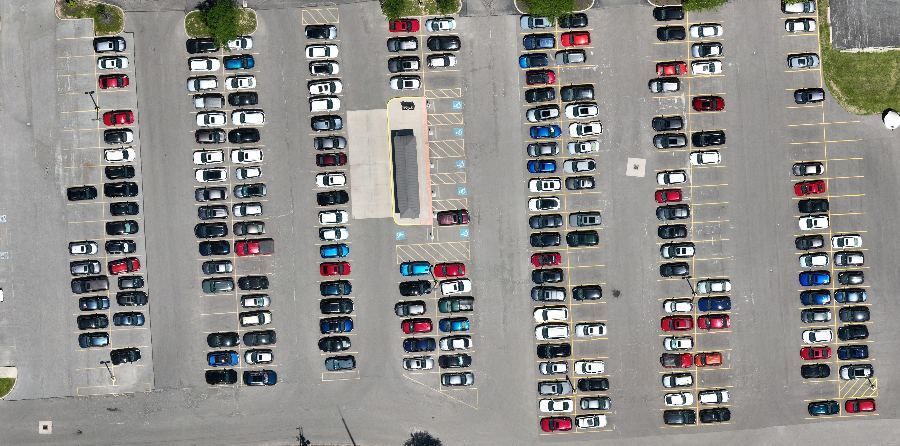
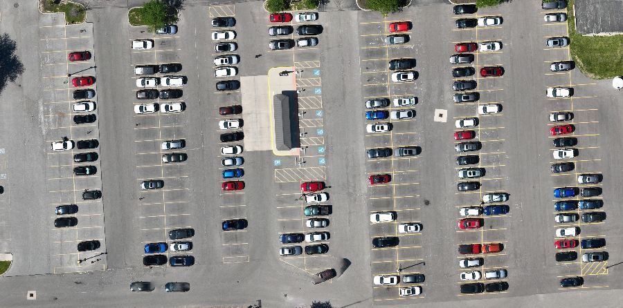
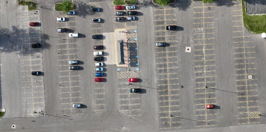
Ground counts take a crew walking the rows and give one number per walk. A map is a record of every stall at a moment in time. It can be recounted, checked and compared lot by lot, hour by hour.
Above: the shuttle lot on one day, cropped to the same frame from five separate flights.
- Lots
- Main campus + shuttle lot
- Flights
- 5 time windows a day, 2 days
- Output
- 20 orthomosaics, registered to each other
- Report
- Vehicle counts by lot and time window
Pick the sensor for the site
| Your site or need | Photo mapping | LiDAR |
|---|---|---|
| Open ground, paving, active construction | Best fit | Works, costs more |
| Visual detail: striping, cracks, materials | Best fit | Limited |
| Ground under trees or brush | Can't see it | Best fit |
| Contours for design through vegetation | Not reliable | Best fit |
| Stockpiles and earthwork volumes | Best fit | Best fit |
| Wires, poles, thin structures | Often missed | Best fit |
Not sure which fits? Send us the site boundary and we'll tell you. Many jobs use both from one mobilization. See LiDAR services →
Priced by site size, with program rates for repeat flights
Travel within 50 miles of Columbus is included; beyond that, mileage is billed at the IRS rate. Larger sites are priced per acre above the base. Rush schedules add 35%.
Site map
A measured, current map of the site for planning, bids and condition records. Up to 20 acres, then $40/acre.
- Orthomosaic (GeoTIFF + PDF)
- Surface model
- RTK positioning
- 24–48 hour delivery
Engineering mapping
The full set for design and existing conditions. Up to 25 acres, then $80/acre.
- Ground control + checkpoints
- Contours (DWG / SHP)
- Point cloud and 3D model
- Accuracy report
Progress mapping
Monthly or milestone maps for the life of the job, on programs of 6 or more flights.
- Maps aligned to each other
- Volume checks +$450
- Upload to Procore
Need only a 3D model of a building or structure? Standalone models with a hosted viewer start at $1,250. Bidding a job? Our Bid-Day Site Pack (current map, oblique photos and a rough earthwork estimate in 72 hours) starts at $2,250.
Frequently asked
Does a drone map replace a land survey?
No. ARO Aerial is not a licensed surveying firm. Our maps supplement your surveyor's work: they set control, and we deliver dense, measured data around it. Anything that needs a seal goes through your PLS.
What coordinate system do you deliver in?
Usually Ohio State Plane (North or South zone), NAD83(2011), US survey feet, with NAVD88 elevations. If your project uses something else, we deliver in that and confirm it against your control first.
Do we need ground control points?
For relative measurements, such as areas, volumes and month-to-month change, RTK positioning alone is often enough. For tying into a survey or design drawings, ground control and checkpoints from your surveyor give a measured, reportable accuracy.
How big a site can you map?
From a single building to hundreds of acres. Large sites are flown in sections and processed as one map.
How do we open the files?
GeoTIFFs open in Civil 3D, ArcGIS, QGIS and Global Mapper. We also send a hosted viewer link so people without GIS software can view, measure and comment in a browser.
Often booked together
Get a measured picture of your site.
Send the address or a KMZ of the boundary, what you need to measure and your deadline. We'll reply with a fixed quote and a flight date.