About ARO Aerial: Credentials, Fleet & Procurement Profile

ARO Aerial

ARO Aerial is a Columbus, Ohio drone data company founded and flown by Adrian K. O'Dell, an FAA Part 107 pilot since 2019. ARO is State of Ohio MBE and EDGE and City of Columbus MBE certified, and captures LiDAR, mapping, thermal and progress data for engineering, architecture and construction teams across Central Ohio.

A solid black circle centered on the left side of a white background.

FAA Part 107

A single solid black circle centered on the left side against a white background.

MBE Certified

A solid black circle centered on the left side of a white background.

EDGE Certified

A solid black circle centered on a white background.

OSHA 10 Trained

A single, solid black circle on a plain white background.

L1 Thermographer


ARO Aerial

Diversity & Procurement (MBE, EDGE, SAM.gov)

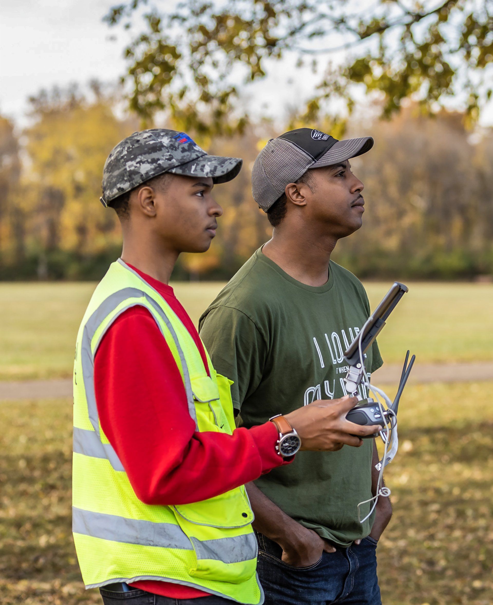
FAA-licensed ARO Aerial pilots running a drone training flight in central Ohio

Why Us

Why Aro Aerial

Columbus-based On-site fast. No travel charge within 50 miles of Columbus. We know Central Ohio.

FAA Certified Full legal authority for commercial UAS operations nationwide.

MBE & EDGE Supports your supplier diversity, DBE, and EDGE program goals.

Site-Ready OSHA 10, bloodborne pathogens, RF awareness, first aid certified — cleared for active job sites, healthcare facilities, and telecom infrastructure.

TOP Level 1 Elite UAS safety designation — above and beyond FAA minimums.

Thermal Certified Level 1 sUAS Thermographer for accurate, defensible infrared reporting.

SAM.gov Registered Ready for federal and federally-funded contract vehicles.

Free Consultations Every engagement starts with a no-obligation scoping conversation.

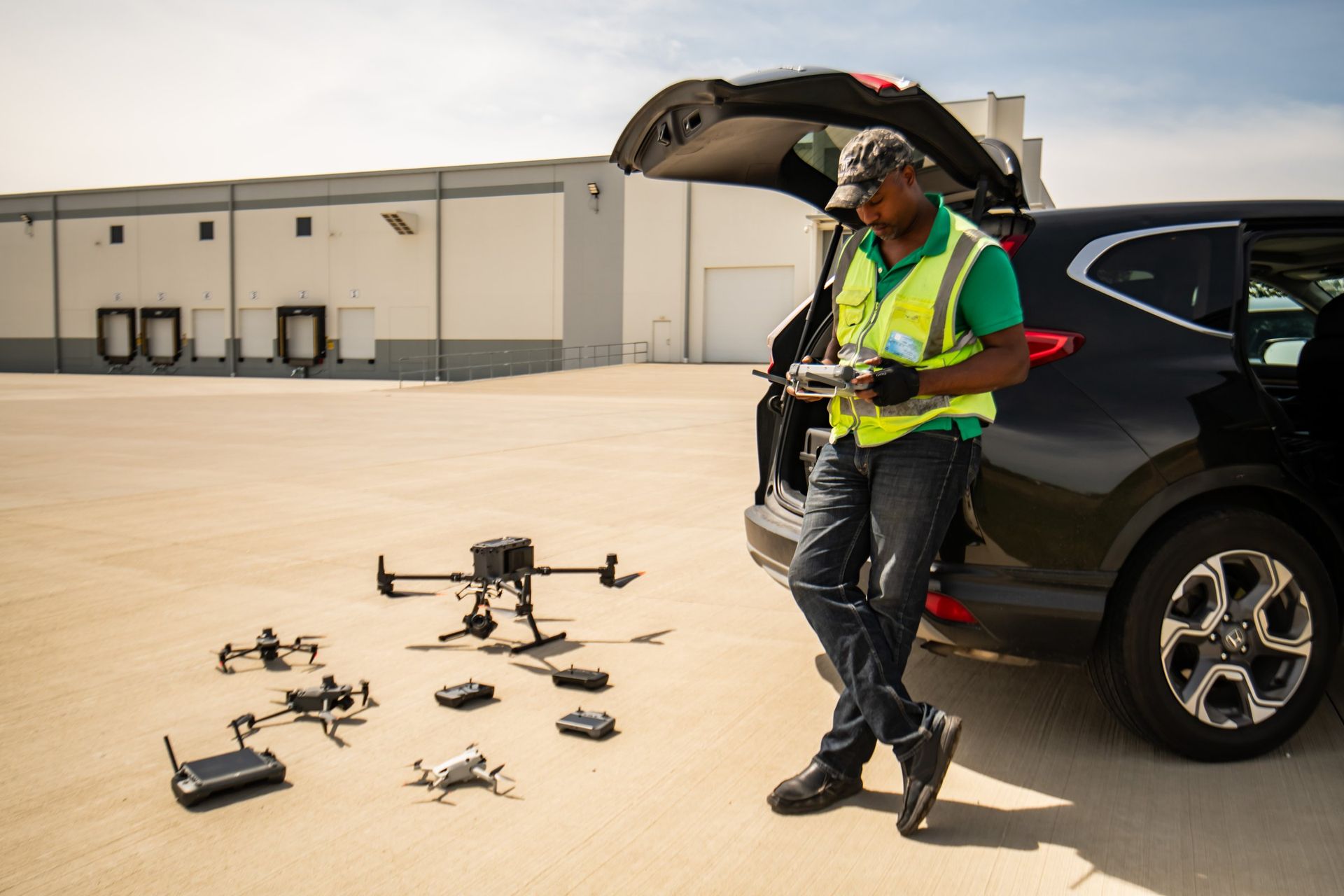
ARO Aerial pilot with the company drone fleet staged for a commercial job in Columbus, Ohio

NAICS Codes

01

541370 

Surveying and Mapping (except Geophysical) Services


02

541990 

All Other Professional, Scientific & Technical Services


03

512110 

Motion Picture & Video Production


04

541922 

Commercial Photography


05

238990 

All Other Specialty Trade Contractors (Inspection Services)

Pilot & Safety Certifications

MBE — Minority Business Enterprise, State of Ohio

EDGE — Encouraging Diversity, Growth and Equity, State of Ohio

FAA Part 107 Remote Pilot Certificate — Federal Aviation Administration

Trusted Operator Program (TOP) Level 1 — AUVSI / DroneU

Level 1 sUAS Thermographer — industry certification

sUAS Safety Certification Level 1 — Unmanned Safety Institute (USI)

OSHA 10-Hour Construction Safety — OSHA / USDOL

Adult First Aid / CPR / AED — American Red Cross

RF Awareness — industry training

Bloodborne Pathogens — OSHA Standard 1910.1030

Occupational Noise Exposure — OSHA Standard 1910.95

Cell Tower Inspection Certified — industry certification

Equipment & Software Ecosystem 

Legal Name: ARO Aerial Inc.

Business Type: Small Business • Minority-Owned

Certifications: MBE (Ohio) • EDGE (Ohio)

SAM.gov Status: Registered — UEI available upon request

Insurance: Fully insured — COI available upon request

Bonding: Not applicable

Service Area: Columbus Metro & Statewide (Ohio) • Regional

Year Established: 2020

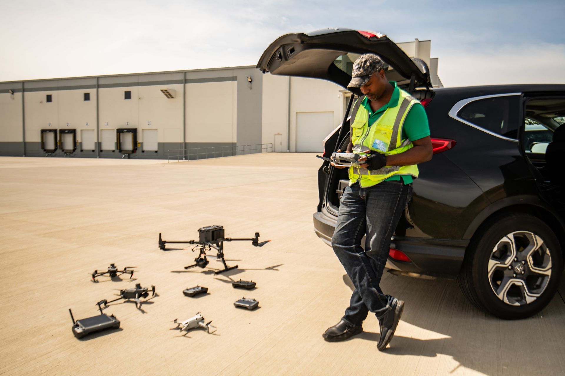
Adrian K. O'Dell, owner and principal pilot of ARO Aerial, with the company drone fleet on an Ohio airfield
Adrian K. O'Dell, owner and principal pilot.
The owner-pilot

Adrian K. O'Dell flies every ARO project

Adrian is the owner and principal pilot of ARO Aerial Inc. He has held his FAA Part 107 Remote Pilot certificate since August 2019 and plans, flies and processes every project himself, so the person who scopes your job is the person on site.

He trained through the Unmanned Safety Institute (USI) and is now a USI Certified Instructor. For more than four years he has led the drone cohort at The PAST Foundation, a Columbus STEM nonprofit, teaching the rules and flight skills he uses on client work. He is an Infrared Training Center Level I sUAS Certified Thermographer, OSHA 10 Construction trained, and trained in RF awareness and tower inspection. He holds a BSBA in Finance and Management of Information Systems from Ashland University, where he competed as an All-American in track and field.

He works alongside licensed surveyors and engineers: their team sets control and seals the work, and ARO delivers the aerial data tied to it.

7+

years of commercial drone operations

978

flights logged

109+

hours of logged flight time

110,000+

aerial photos captured

140+

Central Ohio sites mapped

Flight totals from ARO's AirData flight log as of November 2026.

The fleet

Equipment ARO owns and flies

Every aircraft and sensor below is owned by ARO and flown by Adrian. Mapping and LiDAR flights use RTK corrections for centimeter-level positioning, tied to the control your licensed surveyor sets.

LiDAR and mapping

  • DJI Matrice 350 RTK with Zenmuse L2 LiDAR
  • DJI Matrice 350 RTK with Zenmuse P1 full-frame mapping camera
  • DJI Matrice 300 RTK with a second Zenmuse P1
  • DJI Matrice 400 (carries the P1)
  • DJI Matrice 4E and Mavic 3 Enterprise, both RTK

Thermal and multispectral

  • DJI Mavic 3 Thermal, radiometric, RTK
  • DJI Matrice 210 RTK with Zenmuse XT2 thermal
  • DJI Mavic 3 Multispectral, RTK, for turf and vegetation health
  • Thermal is flown from the air only

Video, photo and interiors

  • DJI Inspire 2 with Zenmuse X7 cinema camera
  • DJI Mavic 3 Cine and Mavic 4 Pro
  • Nikon D850 for ground photo and video
  • iGUIDE PLANIX R1 for measured interior tours
  • Insta360 X4 for ground-level 360° walks

Ground and accuracy

  • Emlid Reach RS2+ and RS3 GNSS receivers
  • Ground targets and checkpoints
  • Control and check shots set by your licensed surveyor
  • Checkpoint report with mapping and LiDAR deliverables

Processing and delivery

  • DJI Terra and PIX4Dmatic processing
  • DroneDeploy and PIX4Dcloud hosted viewers
  • Files for Civil 3D, ArcGIS, Revit and Procore
  • Point clouds (LAS/LAZ), GeoTIFF, DWG, OBJ
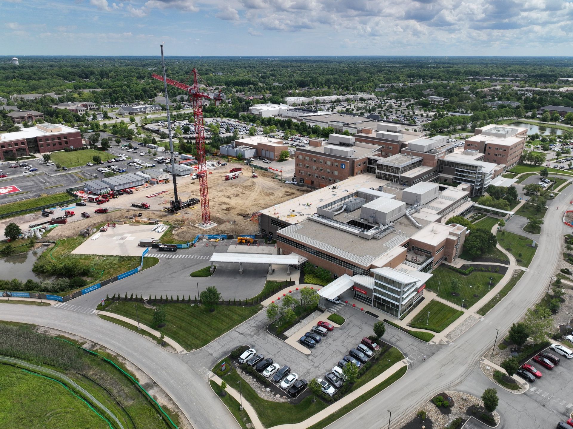
Aerial progress view of a hospital campus expansion in Dublin, Ohio, captured by ARO Aerial

Past Performance — Markets Served

ARO Aerial has delivered aerial photography, mapping, thermal inspection, and videography services to clients across the following sectors:

  • Construction & General Contracting
  • Construction Management & Owner Representation
  • Public Housing Authorities
  • Municipal & Civic Government
  • Transit & Transportation Agencies
  • Healthcare Facilities
  • K-12 & Higher Education
  • Industrial & Utilities Infrastructure
  • Nonprofit & Community Organizations
  • Attractions & Entertainment Venues


Project references and sample work available upon request.

Ready to Put Aerial Intelligence to Work for Your Projects?

Contact us for a free consultation and custom scope. We work with public agencies, contractors, developers, and nonprofits of every size.