LiDAR Scanning & Scan-to-BIM Services for AEC
AEC LiDAR & Scan-to-BIM Services in Columbus, Ohio
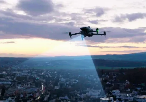
ARO Aerial provides design-grade drone LiDAR scanning, point cloud capture, and scan-to-BIM services for architecture, engineering, and design-build firms across Columbus and Central Ohio. We capture dense, georeferenced 3D point cloud data that architects and engineers use to model existing conditions, generate design surfaces, validate construction against design intent, and produce BIM-ready spatial datasets. Unlike photogrammetry, LiDAR penetrates vegetation and captures complex geometry with sub-inch accuracy — delivering the spatial precision that design professionals require.
We serve architects, civil engineers, structural engineers, MEP consultants, landscape architects, BIM managers, building enclosure consultants, and design-build teams who need accurate point cloud data to drive design decisions — from pre-design existing conditions surveys and scan-to-BIM modeling through construction administration verification and as-built documentation.
FAA Part 107
MBE Certified
EDGE Certified
OSHA 10 Trained
L1 Thermographer
When AEC Teams Need LiDAR
- Capture precise existing conditions data for renovation, adaptive reuse, and retrofit design
- Generate BIM-ready point clouds for scan-to-BIM modeling workflows
- Map bare-earth terrain beneath vegetation for civil and landscape design
- Produce design-grade terrain surfaces and elevation data for grading plans
- Validate as-built conditions against design intent during CA phase
- Support multi-discipline coordination with shared, georeferenced spatial datasets
- Create classified point clouds for clash detection and BIM integration
- Document existing structures and sites at LOD levels required for design development
This is not survey-for-survey's-sake — it's design-grade LiDAR built for architects, engineers, and BIM teams who need point cloud data integrated directly into their design and coordination workflows.

Deliverables (point clouds, terrain models, BIM-ready exports)
1. Existing Conditions Point Clouds
- Dense, classified 3D point clouds capturing buildings, terrain, vegetation, and infrastructure
- Multi-return data separating ground, canopy, and structure layers
- GCP-aligned for survey-grade positional accuracy
- Directly importable into Revit, Civil 3D, Navisworks, ArchiCAD, and Rhino
- Foundation for scan-to-BIM modeling and existing conditions documentation
2. Scan-to-BIM Ready Datasets
- Point clouds processed, classified, and registered for BIM modeling workflows
- LOD-appropriate data for architectural, structural, and MEP modeling
- Coordinate-aligned to project datum for seamless BIM integration
- Compatible with Revit, Navisworks, and cloud-based BIM coordination platforms
- Delivered with metadata, accuracy documentation, and coordinate reference
3. Design-Grade Terrain & Elevation Models
- Digital Surface Models (DSM) and Digital Terrain Models (DTM) for civil and landscape design
- Bare-earth terrain mapping on vegetated, undeveloped, and complex sites
- Contour generation at project-specified intervals
- Slope, aspect, and drainage analysis for site design
- Design surface exports formatted for Civil 3D and grading software
4. As-Designed vs. As-Built Verification
- Point cloud comparison against BIM models and design documents
- Deviation analysis with quantified tolerances
- Structural, civil, and envelope verification
- Visual and quantitative reporting for design teams
- Documented records for QA/QC, commissioning, and owner turnover
5. Comprehensive LiDAR Deliverable Packages
Every project includes:
- Classified point clouds in LAS, LAZ, E57, and RCP formats
- Elevation models, contour maps, and terrain surfaces
- Accuracy documentation and GCP verification records
- Processing methodology and coordinate reference documentation
- Cloud-based access for the entire design team
How LiDAR Works for AEC Teams
1. Project Scoping
We coordinate with your project architect, BIM manager, or lead engineer to define:
- Areas and structures to be captured
- Required accuracy standards and LOD level
- Coordinate datum and project reference system
- Deliverable formats and BIM platform integration
- Capture schedule aligned to design milestones (SD, DD, CD, CA)
2. LiDAR Data Capture
FAA Part 107–certified pilot executes the mission:
- Systematic flight paths optimized for target point density
- Multi-return LiDAR sensor deployment with real-time quality monitoring
- GCP-aligned, GPS/INS-referenced data collection
- Complementary ground-level scanning for interior and under-canopy areas (as needed)
- Safety-first operations with full regulatory compliance
3. Processing & Delivery
You receive design-ready outputs:
- Classified, registered, QA-verified point clouds
- Elevation models, contour maps, and terrain surfaces
- As-designed vs. as-built deviation reports (if applicable)
- Data formatted for your BIM, CAD, and GIS platforms
- Cloud-based access for the entire design team
Service Area — Columbus & Central Ohio
We provide AEC LiDAR and scan-to-BIM services for projects in:
- Columbus
- New Albany
- Dublin
- Westerville
- Grove City
- Hilliard
- Delaware
- Marysville
- Lancaster
- Newark
- And all surrounding Central Ohio markets


Use Cases
01
Pre-Design & Existing Conditions
- Existing conditions point cloud capture for renovation, adaptive reuse, and retrofit projects
- Bare-earth terrain mapping on undeveloped and vegetated sites for site design
- Structural and building geometry capture for scan-to-BIM modeling
- Baseline elevation and site survey data for civil and landscape design
- Feasibility analysis with precise dimensional and spatial data
02
Design Development
- Scan-to-BIM modeling from point cloud data at required LOD
- Design surface generation and grading plan validation
- Multi-discipline coordination with shared georeferenced datasets
- Clash detection support between existing conditions and proposed design
- Volumetric analysis for earthwork estimation and cost modeling
03
Construction Administration
- As-designed vs. as-built verification during construction
- Structural and civil deviation monitoring
- Envelope and facade geometry validation
- Multi-discipline coordination with current spatial data
- Commissioning documentation support
04
Project Completion & Post-Occupancy
- Final as-built point clouds and terrain models
- As-built vs. as-designed comparison records
- Owner turnover documentation with classified spatial data
- Facility management baseline datasets
- Portfolio and case study documentation
Why AEC Firms Choose ARO Aerial
- 6+ years of professional LiDAR and point cloud capture experience
- Understands AEC project phases, BIM workflows, and scan-to-BIM requirements
- GCP-aligned, survey-grade accuracy (sub-inch horizontal and vertical)
- Vegetation-penetrating bare-earth capability for site design
- Deliverables formatted for Revit, Civil 3D, Navisworks, ArchiCAD, and GIS platforms
- FAA Part 107 certified
- Fully insured
- Fast turnaround aligned to design milestones
- Clear communication with architects, engineers, and BIM managers

AEC LiDAR & Scan-to-BIM — Frequently Asked Questions
What is scan-to-BIM and how does LiDAR support it?
Scan-to-BIM is the process of capturing a building or site with LiDAR to produce a dense 3D point cloud, which is then used as the spatial reference for creating an accurate BIM model in Revit, ArchiCAD, or similar platforms. LiDAR provides the precise dimensional data needed to model existing conditions at the LOD level required for design.
How do architects and engineers use LiDAR data?
Architects and engineers use LiDAR data to capture existing conditions for renovation and adaptive reuse design, generate terrain surfaces for site and civil design, validate as-built construction against design intent, coordinate across disciplines with shared spatial datasets, and produce BIM-ready models from real-world measurements.
How accurate is drone LiDAR for AEC projects?
With ground control points (GCPs) and calibrated multi-return sensors, drone LiDAR achieves sub-inch horizontal and vertical accuracy — meeting the precision requirements for architectural, structural, and civil engineering design workflows.
When should AEC teams schedule LiDAR scanning?
Key capture points include pre-design (existing conditions and terrain survey), design development (design surface validation and BIM coordination), construction administration (as-designed vs. as-built verification), and project completion (as-built documentation and owner turnover). Renovation and adaptive reuse projects benefit most from early-phase scanning.
Get Started with AEC LiDAR & Scan-to-BIM
Need LiDAR scanning or scan-to-BIM data for your AEC project?
ARO Aerial delivers design-grade point cloud data, terrain models, and BIM-ready spatial datasets across Central Ohio — built for architects, engineers, and design teams.
