Aerial Photography & Site Documentation for AEC Firms
AEC Aerial Photography & Site Documentation in Columbus, Ohio
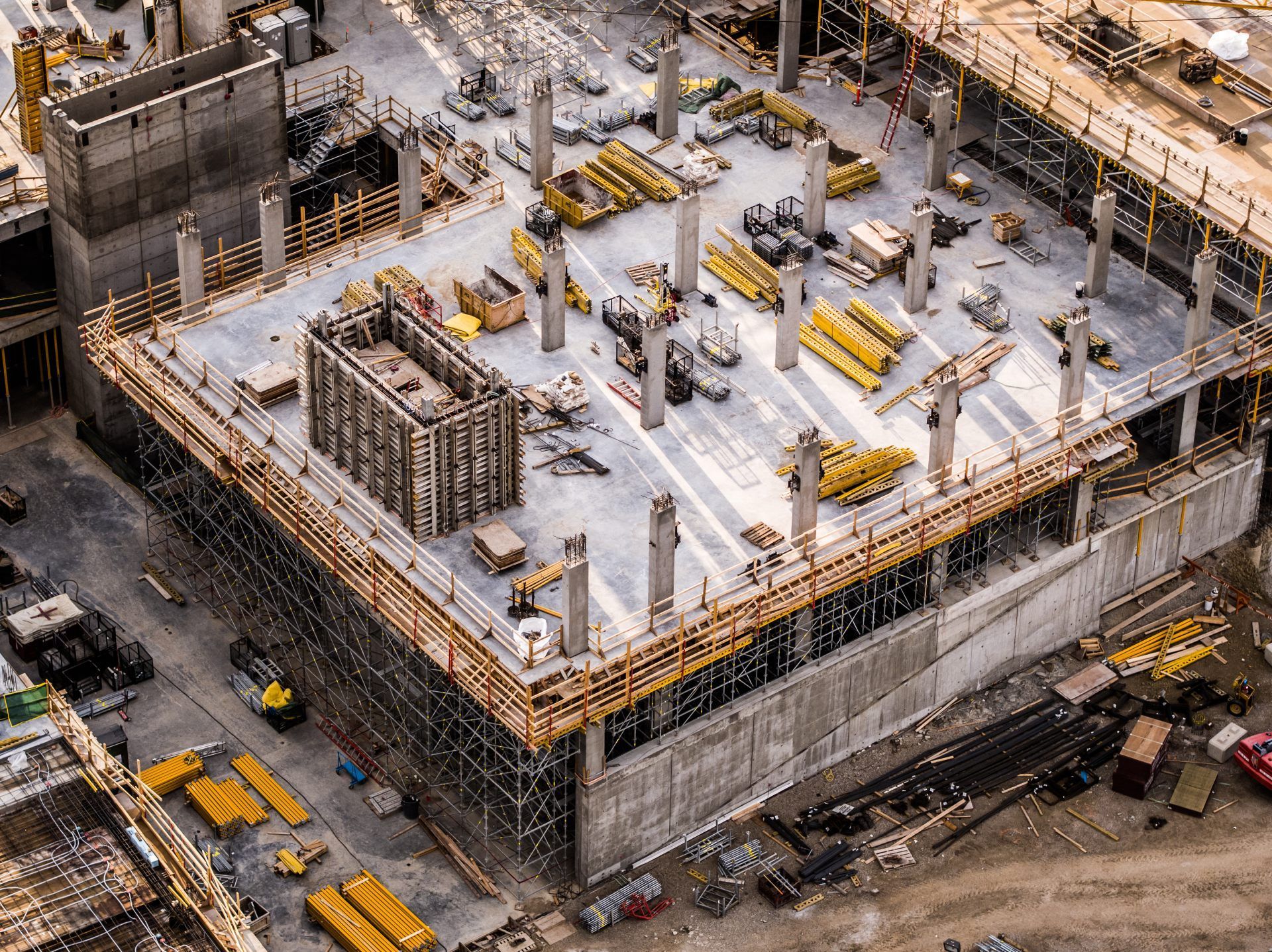
ARO Aerial provides professional aerial photography and site documentation services for architecture, engineering, and design-build firms across Columbus and Central Ohio. We capture high-resolution, geo-tagged aerial imagery that gives design teams site-wide context, existing conditions visibility, and visual documentation across every phase of the project lifecycle — from pre-design assessment through construction administration and post-occupancy evaluation.
We serve architects, civil engineers, structural engineers, MEP consultants, landscape architects, environmental engineers, and design-build teams who need accurate, repeatable aerial imagery to inform design decisions, validate construction progress against design intent, and document project outcomes for portfolios, case studies, and regulatory submissions.
FAA Part 107
MBE Certified
EDGE Certified
OSHA 10 Trained
L1 Thermographer
When AEC Teams Need Aerial Photography
- Document existing site conditions before design begins
- Capture site context — adjacencies, access, topography, vegetation, and surrounding development
- Validate construction progress against design intent during CA phase
- Create visual records for design review meetings and client presentations
- Support RFI responses with current, geo-tagged site imagery
- Build portfolio and case study assets from completed projects
- Document phased construction for owner and design team coordination
- Provide regulatory and permitting agencies with current aerial site documentation
This is not marketing photography — it's design-grade site documentation built for architects, engineers, and design teams who need accurate visual context at every project phase.

What We Deliver (resolution, geo-tagging, formats)
1. Existing Conditions Photography
- Pre-design aerial site documentation from multiple altitudes and angles
- Context photography capturing adjacencies, utilities, access, and vegetation
- Geo-tagged imagery with GPS coordinates and timestamps
- Baseline visual records for design reference
2. Design Phase Site Documentation
- Aerial imagery aligned to design milestones (SD, DD, CD phases)
- Site context updates as conditions change during design development
- Visual documentation for client presentations and design review
- Comparison sets showing site evolution from pre-design through permitting
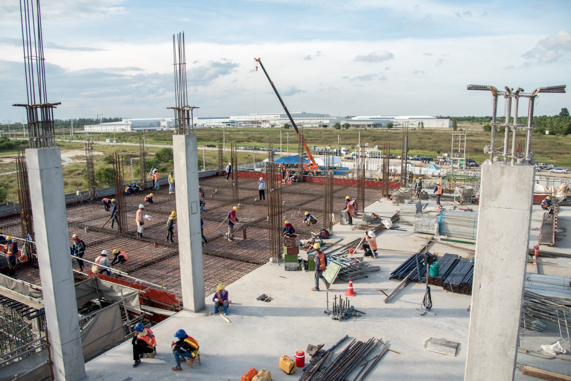
3. Construction Administration Photography
- Recurring aerial capture during CA phase — weekly, bi-weekly, or milestone-based
- Design intent vs. field conditions visual comparison
- RFI response support with current, dated imagery
- Coordination documentation for multi-discipline teams
4. Project Completion & Portfolio Documentation
- Final project photography for case studies, award submissions, and portfolios
- Before/after comparison sets documenting design impact
- Aerial perspectives showcasing design in context
- Marketing-ready imagery for firm websites and proposals
5. Regulatory & Compliance Photography
- Aerial documentation for zoning, variance, and permitting applications
- Environmental and stormwater compliance photography
- Historic preservation and context documentation
- Timestamped records for regulatory agencies and review boards
How a Capture Mission Works
1. Project Scoping
We coordinate with your project architect or lead engineer to define:
- Areas of interest, site boundaries, and context zones
- Required capture phases (pre-design, DD, CA, completion)
- Deliverable formats, resolution, and integration needs
- Capture schedule aligned to design milestones
2. Aerial Capture
FAA Part 107–certified pilot executes the mission:
- Systematic multi-altitude and multi-angle coverage
- Geo-tagged imagery with full metadata
- Consistent parameters for time-series comparison
- Safety-first operations with full regulatory compliance
3. Processing & Delivery
You receive production-ready outputs:
- Color-corrected, resolution-optimized imagery
- Organized by phase, date, and project area
- Cloud-based access for the entire design team
- Formatted for presentations, reports, and design platforms
Service Area — Columbus & Central Ohio
We provide AEC aerial photography and site documentation for projects in:
- Columbus
- New Albany
- Dublin
- Westerville
- Grove City
- Hilliard
- Delaware
- Marysville
- Lancaster
- Newark
- And all surrounding Central Ohio markets
Common AEC Use Cases
01
Pre-Design & Assessment
- Existing conditions site documentation
- Context photography for site analysis and feasibility studies
- Environmental and regulatory baseline records
- Adjacency and access documentation for design teams
02
Design Development
- Updated site imagery as conditions change during design
- Visual context for client presentations and stakeholder meetings
- Coordination imagery for multi-discipline design teams
- Permitting and zoning application support
03
Construction Administration
- Recurring aerial documentation during CA phase
- Design intent vs. field conditions visual comparison
- RFI response support with current site imagery
- Multi-discipline coordination and progress tracking
04
Project Completion & Post-Occupancy
- Final project photography for portfolios and case studies
- Before/after documentation showing design impact
- Post-occupancy site condition records
- Award submission and publication-ready imagery
Why AEC Firms Choose ARO Aerial
- 6+ years of professional aerial documentation experience
- Understands AEC project phases and design team workflows
- Geo-tagged, calibrated imagery with repeatable methodology
- Deliverables formatted for design review, client presentations, and regulatory submissions
- FAA Part 107 certified
- Fully insured
- Fast turnaround aligned to design milestones
- Clear communication with architects, engineers, and project managers
Frequently Asked Questions
How do architects use aerial photography?
Architects use aerial photography to document existing site conditions, capture context for design decisions, validate construction progress against design intent during CA, and create portfolio imagery of completed projects.
What is aerial site documentation for AEC projects?
Aerial site documentation is the systematic capture of geo-tagged, high-resolution aerial imagery across project phases — from pre-design assessment through construction administration and project completion — to support design decisions, coordination, compliance, and archival records.
When should AEC teams schedule aerial photography?
Key capture points include pre-design (existing conditions), design development (site context updates), construction administration (progress vs. design intent), and project completion (portfolio and case study documentation). Recurring programs during CA provide the most value for design coordination.
What deliverables do AEC teams receive?
Teams receive geo-tagged, color-corrected, high-resolution aerial imagery organized by project phase and date — formatted for design review platforms, client presentations, regulatory submissions, and portfolio documentation, with cloud-based access for the entire team.
Get Started with ARO Aerial
Need aerial photography and site documentation for your AEC project?
ARO Aerial delivers calibrated, phase-aligned, design-grade aerial imagery across Central Ohio — built for architects, engineers, and design teams.
