Construction LiDAR Services
Construction LiDAR Services in Columbus, Ohio
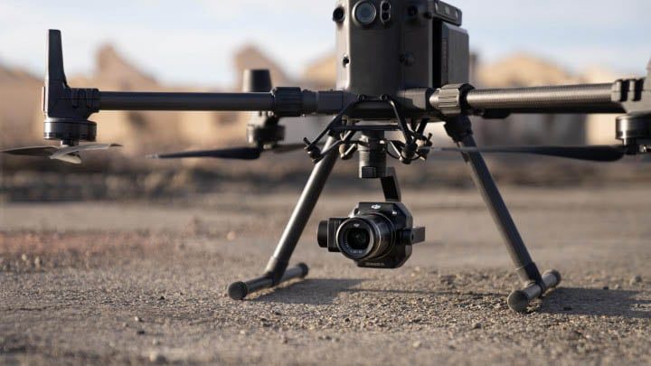
ARO Aerial provides construction-grade drone LiDAR scanning and point cloud services for jobsites across Columbus and Central Ohio. We capture dense, georeferenced 3D point cloud data that delivers survey-grade terrain models, volumetric calculations, and existing conditions documentation — giving construction teams the spatial intelligence they need to plan, build, and verify with precision. Unlike photogrammetry, LiDAR penetrates vegetation, maps complex terrain beneath canopy, and produces bare-earth elevation data critical for grading design, earthwork verification, and site civil coordination.
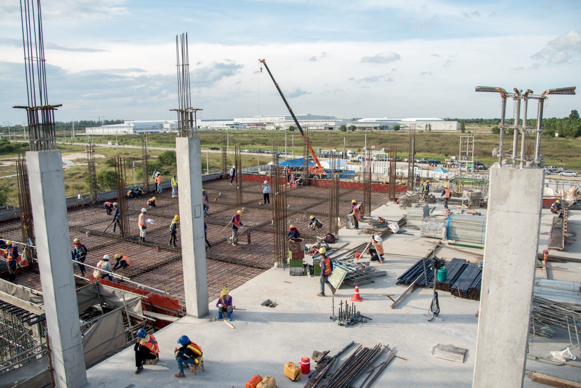
We serve general contractors, construction managers, civil contractors, site work firms, developers, and owners — from pre-construction topo surveys through final as-built documentation. Every mission is GCP-aligned, processed to survey-grade accuracy, and delivered in formats ready for Civil 3D, Procore, BIM platforms, and your engineering team's existing workflow.
FAA Part 107
MBE Certified
EDGE Certified
OSHA 10 Trained
L1 Thermographer
Why Construction Teams Use LiDAR
- Capture survey-grade topographic data faster than traditional ground crews
- Map bare-earth terrain beneath vegetation, brush, and tree canopy
- Verify grading, excavation, and subgrade accuracy against design surfaces
- Track earthwork volumes (cut/fill) with sub-inch precision
- Generate existing conditions data for pre-construction planning and design
- Produce classified point clouds for BIM coordination and clash detection
- Support RFIs, change orders, and quantity disputes with defensible elevation data
- Create as-built terrain documentation for owner turnover and closeout
This is not consumer-grade scanning — it's construction-grade LiDAR built for PMs, supers, site civil teams, and engineers who need survey-quality data on a construction timeline.
What We Deliver
1. Georeferenced Point Clouds
- Dense, classified 3D point clouds with millions of data points per acre
- Multi-return data separating ground, vegetation, and structure layers
- GCP-aligned for survey-grade positional accuracy
- Exported in LAS, LAZ, and other industry-standard formats
- Compatible with Civil 3D, Revit, Navisworks, and GIS platforms
2. Digital Elevation Models (DEM)
- Digital Surface Models (DSM) capturing top-of-surface elevations
- Digital Terrain Models (DTM) revealing bare-earth ground beneath vegetation
- Contour line generation at project-specified intervals
- Design surface comparison and cut sheet overlays
- GeoTIFF and grid exports for engineering and civil design
3. Volumetric & Earthwork Calculations
- Cut/fill measurements against design surfaces
- Stockpile volume tracking and material inventory verification
- Grade verification at each phase of site work
- Progress-over-time comparison with repeat scans
- Exportable reports for project engineers, owners, and estimators
4. Topographic & Existing Conditions Surveys
- Comprehensive topo data for pre-construction planning
- Bare-earth terrain mapping on undeveloped, forested, or overgrown sites
- Boundary-referenced elevation models
- Drainage, slope, and watershed analysis
- Baseline data for design, permitting, and environmental review
5. As-Built & Closeout Documentation
- Final site condition terrain models
- As-built surface verification against design intent
- Georeferenced elevation records for warranty and compliance
- Owner turnover packages with classified point cloud data
- Archival documentation for long-term project records
How Construction LiDAR Works
1. Project Scoping
We coordinate with your PM, superintendent, or site civil team to define:
- Areas of interest and required point density
- Accuracy standards and GCP placement strategy
- Coordinate datum and vertical reference
- Scan frequency (one-time, milestone-based, or recurring)
- Deliverable formats and platform integration (Civil 3D, Procore, BIM, GIS)
2. On-Site LiDAR Capture
FAA Part 107–certified pilot performs:
- Systematic flight paths optimized for target point density
- Multi-return LiDAR sensor deployment with real-time quality monitoring
- GCP-aligned, GPS/INS-referenced data collection
- Coordination with site operations to minimize disruption
- Safety-first operations compliant with jobsite protocols
3. Processing & Delivery
You receive:
- Classified, filtered, QA-verified point clouds
- Digital elevation models (DSM/DTM) and contour maps
- Volumetric and earthwork reports
- Design surface comparison overlays
- Cloud-based access for your entire project team
Service Area — Columbus & Central Ohio
We provide construction LiDAR services for projects in:
- Columbus
- New Albany
- Dublin
- Westerville
- Grove City
- Hilliard
- Delaware
- Marysville
- Lancaster
- Newark
- And all surrounding Central Ohio markets

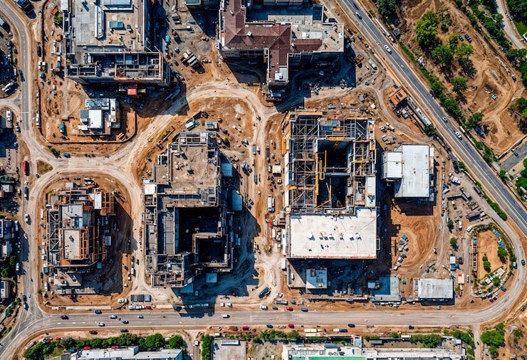
Construction Use Cases
01
Pre-Construction
- Existing conditions topo surveys on undeveloped and vegetated sites
- Bare-earth terrain mapping beneath canopy for civil design
- Site logistics and access planning
- Baseline elevation data for permitting and environmental review
- Design surface generation for grading plans
02
Earthwork & Site Prep
- Cut/fill volume tracking against design surfaces
- Subgrade and grade verification at each phase
- Excavation progress documentation
- Material stockpile measurement and inventory
- Erosion and drainage monitoring
03
Vertical Construction
- Foundation and structural elevation verification
- Site condition monitoring around active structures
- Coordination with civil, MEP, and structural trades
- Progress documentation for owners and lenders
- Plan-vs-actual terrain comparison
04
Closeout
- As-built terrain and elevation documentation
- Final surface verification against design intent
- Warranty baseline records
- Owner turnover packages with classified point cloud data
- Archival records for long-term project documentation
Why GCs Choose ARO Aerial
- 6+ years of construction-focused LiDAR and mapping experience
- GCP-aligned, survey-grade accuracy (sub-inch horizontal and vertical)
- Vegetation-penetrating bare-earth capability
- Engineering-ready deliverables formatted for Civil 3D, BIM, and GIS
- FAA Part 107 certified
- Fully insured
- Fast turnaround — survey-grade data without surveyor delays
- Clear communication with PMs, supers, and site civil teams
- Trusted by GCs, CMs, civil contractors, and developers across Ohio
Frequently Asked Questions
What is construction LiDAR scanning?
Construction LiDAR scanning uses drone-mounted laser sensors to capture dense, georeferenced 3D point cloud data of a jobsite. The resulting data produces survey-grade terrain models, elevation surfaces, and volumetric calculations used for site planning, earthwork verification, and as-built documentation.
Why use LiDAR instead of photogrammetry on a construction site?
LiDAR penetrates vegetation, tree canopy, and ground cover to map bare-earth terrain — critical for pre-construction topo surveys on undeveloped or overgrown sites. It also delivers higher vertical accuracy than photogrammetry, making it the preferred method for grading verification, cut/fill calculations, and design surface comparison.
How accurate is construction LiDAR?
With ground control points (GCPs) and calibrated multi-return sensors, construction LiDAR achieves sub-inch horizontal and vertical accuracy — comparable to traditional ground survey methods but captured faster, with broader coverage, and without ground crew access to every point on the site.
What do construction teams receive from a LiDAR scan?
Teams receive classified point clouds, digital elevation models (DSM/DTM), contour maps, volumetric and earthwork reports, design surface comparison overlays, and cloud-based access for the entire project team. All data is formatted for Civil 3D, BIM, GIS, and project management platforms.
Get Construction-Grade LiDAR for Your Project
Need construction-grade LiDAR scanning for your project?
ARO Aerial delivers survey-grade point cloud data, terrain models, and earthwork verification across Central Ohio — built for construction timelines and engineering workflows.
