LiDAR for Architecture & Design
LiDAR for Architecture & Design in Columbus, Ohio
ARO Aerial Inc | Professional Drone-Based & Terrestrial LiDAR Scanning
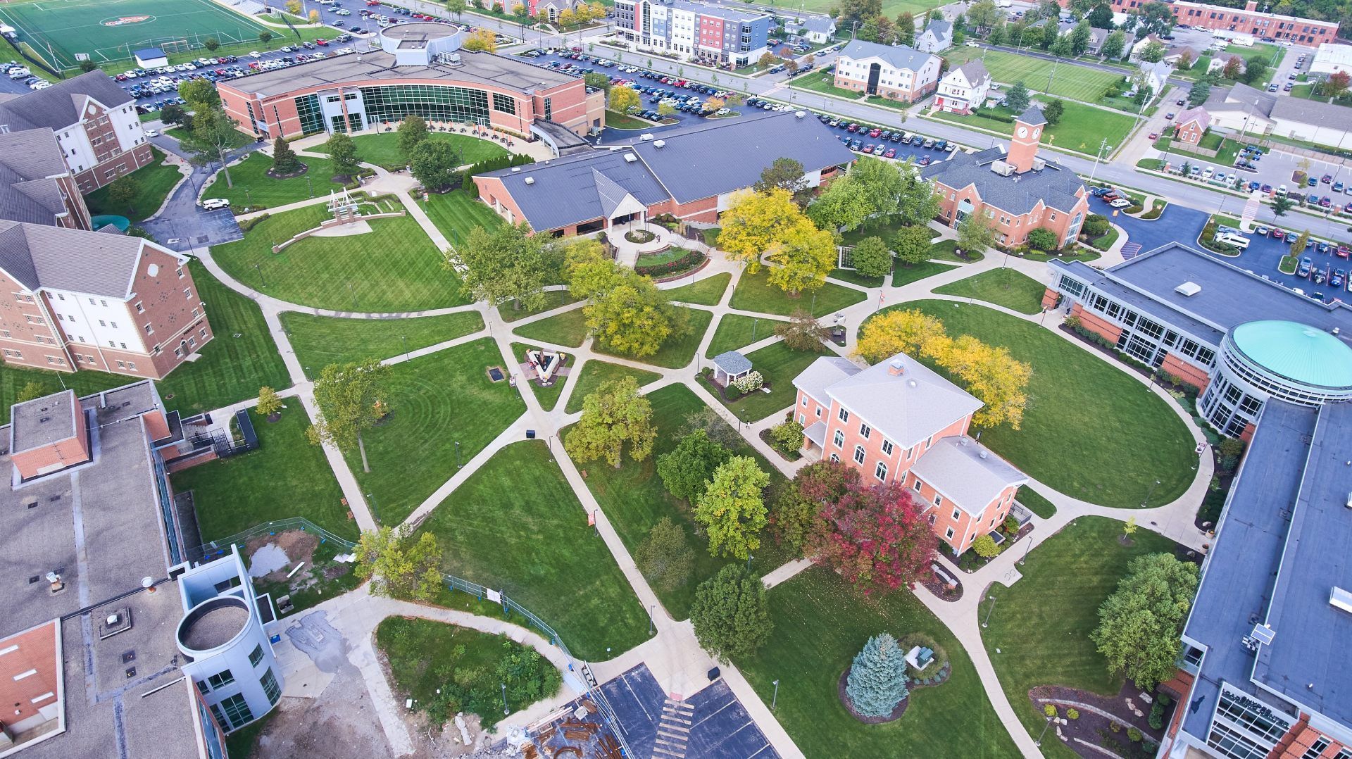
ARO Aerial provides professional drone-based and terrestrial LiDAR scanning for architecture and design firms across Columbus and Central Ohio. We capture dense, georeferenced 3D point cloud data that documents existing buildings, sites, and terrain with survey-grade accuracy — giving design teams the precise spatial foundation they need for renovation, adaptive reuse, new construction, and historic preservation projects. Every scan integrates directly into BIM, CAD, and design platforms.
We work with architects, landscape architects, interior designers, and historic preservation specialists — providing classified point cloud data and as-existing models tailored to the design process. Whether you need a point cloud of an existing building for Revit modeling, bare-earth terrain data for landscape design, or a complete site scan for context modeling, ARO Aerial delivers accurate, integration-ready LiDAR data formatted for your tools and workflow.
FAA Part 107
MBE Certified
EDGE Certified
OSHA 10 Trained
L1 Thermographer
Why Architecture & Design Teams Use LiDAR
- Capture precise as-existing conditions — buildings, interiors, terrain, and site features — in 3D
- Generate point clouds that import directly into Revit, ArchiCAD, SketchUp, Rhino, and AutoCAD
- Document complex geometry, irregular surfaces, and historic details that manual measurement cannot efficiently capture
- Create bare-earth terrain models for landscape architecture and site-responsive design
- Build accurate as-existing BIM models from classified point cloud data
- Support renovation, adaptive reuse, and historic preservation with defensible spatial documentation
- Eliminate repeat site visits — capture everything once with millimeter-level detail
- Provide survey-grade baselines for regulatory submissions, zoning analysis, and permitting
This is not generic scanning — it's design-grade LiDAR data built for project architects, landscape architects, and design teams who need accuracy and BIM integration.
What We Deliver
1. Classified Point Clouds
- Dense, georeferenced 3D point clouds with millions of data points
- Classified by return type — ground, vegetation, structure, interior elements
- Multi-return data capturing layered surfaces and complex geometry
- Exported in LAS, LAZ, E57, and RCP formats for direct design platform integration
- Compatible with Revit, ArchiCAD, SketchUp, Rhino, AutoCAD, and Navisworks
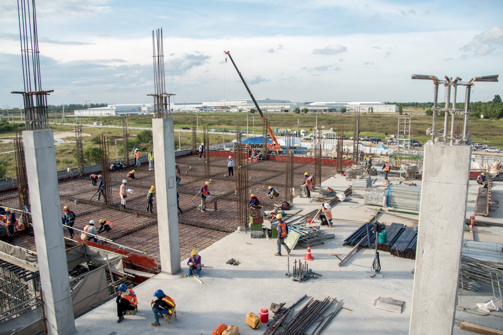
2. As-Existing Building Documentation
- Complete exterior and interior scanning of existing structures
- Complex geometry, irregular surfaces, and architectural details captured at millimeter precision
- Foundation for as-existing BIM models and renovation design
- Ideal for historic buildings, adaptive reuse projects, and structures without reliable drawings
3. Digital Terrain Models (DTM) for Site Design
- Bare-earth terrain models beneath vegetation for landscape architecture
- Contour line generation at custom intervals
- Slope, drainage, and watershed analysis
- Topographic baselines for grading design and site-responsive architecture
4. Context & Massing Data
- 3D scanning of surrounding structures and site context
- Point cloud data for shadow studies, view analysis, and massing studies
- Neighboring building geometry for contextual BIM models
- Streetscape and adjacency documentation
5. Scan-to-BIM Ready Deliverables
- Point clouds processed and optimized for BIM modeling workflows
- Registration, alignment, and noise filtering for clean design-ready data
- Coordinate system alignment to project datum
- Delivered with documentation of accuracy, methodology, and coordinate reference
How It Works
1. Project Scoping
We coordinate with your project architect or design lead to define:
- Areas of interest — building, interior, site, surrounding context
- Required accuracy and point density
- Deliverable formats and design platform integration (Revit, Rhino, AutoCAD, etc.)
- Coordinate system and project datum alignment
- Schedule and access logistics
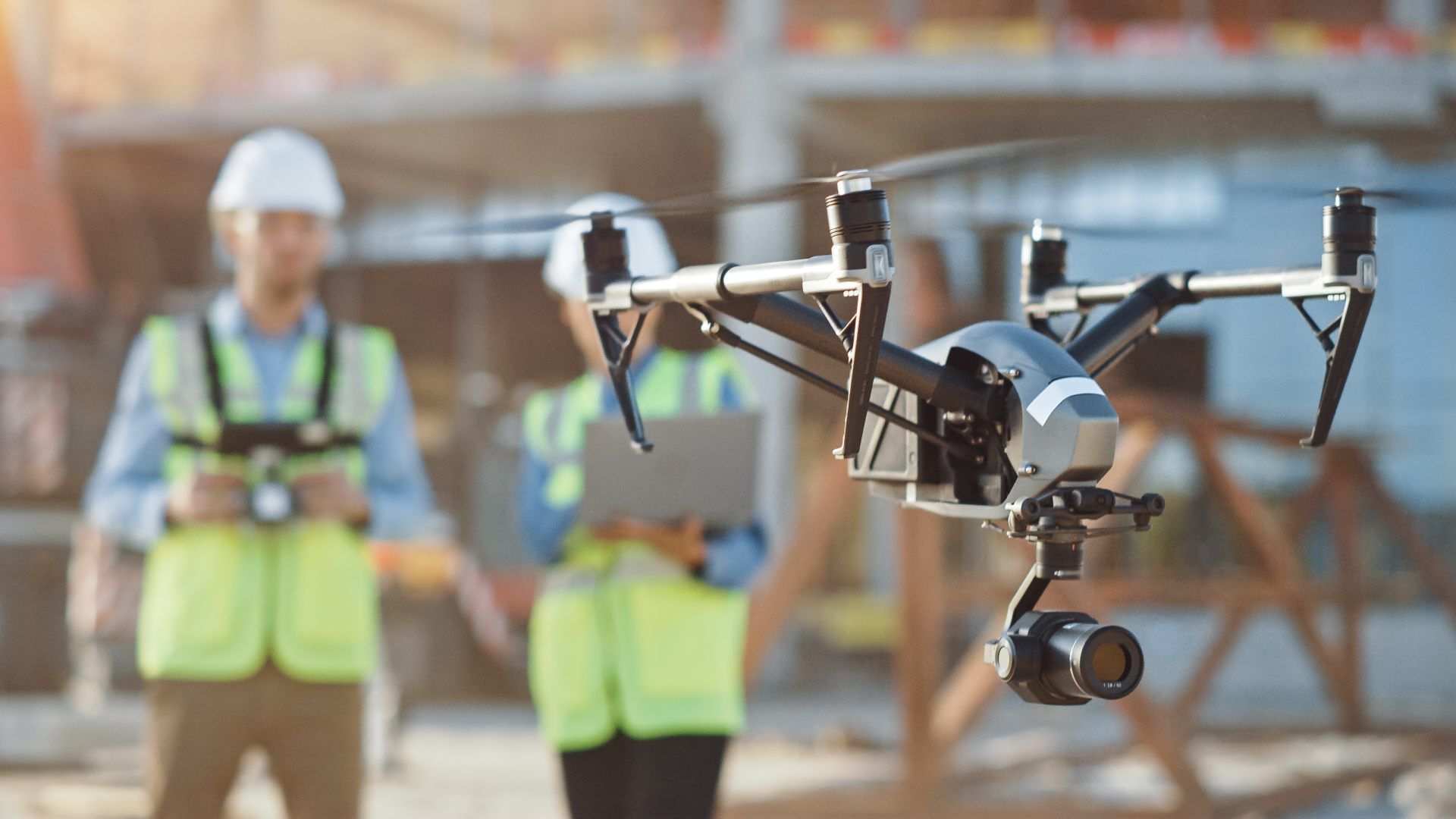
2. LiDAR Capture
Our team executes a systematic scan:
- Drone-mounted LiDAR for site terrain, roofs, and large-area coverage (FAA Part 107–certified)
- Terrestrial scanning for building interiors and detailed facades
- GCP-aligned, GPS/INS-referenced data collection
- Consistent methodology for accuracy and repeatability
3. Processing & Delivery
You receive design-ready outputs:
- Classified, filtered, and QA-verified point clouds
- Digital terrain models and contour maps (if applicable)
- Data exported in your required formats for direct platform integration
- Cloud-based access for your design team
Service Area — Columbus & Central Ohio
We provide LiDAR scanning for architecture and design firms with projects in:
- Columbus
- New Albany
- Dublin
- Westerville
- Grove City
- Hilliard
- Delaware
- Marysville
- Lancaster
- Newark
- And all surrounding Central Ohio markets

Architecture & Design Use Cases
01
Renovation & Adaptive Reuse
- As-existing building documentation for structures without reliable drawings
- Point cloud foundation for renovation BIM models
- Interior and exterior geometry captured in a single scan session
- Condition documentation for feasibility studies and design planning
02
Historic Preservation
- Precise documentation of historic details, ornament, and complex geometry
- Archival-quality spatial records for preservation planning
- Regulatory and National Register documentation support
- Non-contact, non-destructive capture methodology
03
New Construction — Site & Context
- Bare-earth terrain models for site-responsive design
- Surrounding context scanning for massing and shadow studies
- Topographic baselines for grading, drainage, and landscape design
- View corridor and adjacency documentation
04
Campus & Multi-Building Documentation
- Portfolio-scale scanning across multiple buildings and sites
- Standardized coordinate systems and deliverable formats
- Phased scanning programs for large campuses
- Centralized point cloud library for ongoing design reference
Why Design Firms Choose ARO Aerial
- 6+ years of professional LiDAR and point cloud experience
- BIM-ready deliverables — Revit, ArchiCAD, Rhino, AutoCAD, Navisworks
- Survey-grade accuracy with GCP alignment
- Understands the design process — existing conditions through completed project
- Combined aerial + terrestrial scanning capability
- FAA Part 107 certified and fully insured
- Fast turnaround with clear communication
- Trusted by architecture, preservation, and design firms across Ohio
Frequently Asked Questions (FAQ)
Why do architects need LiDAR scanning?
LiDAR provides architects with precise, millimeter-accurate 3D point cloud data of existing buildings, sites, and terrain — enabling accurate as-existing BIM models, renovation design, and site-responsive architecture without relying on incomplete or outdated drawings.
Can LiDAR point clouds be used in Revit and BIM?
Yes. ARO Aerial delivers point clouds in formats (RCP, E57, LAS) that import directly into Revit, ArchiCAD, Navisworks, and other BIM platforms. Point clouds serve as the spatial reference for modeling existing conditions and coordinating new design elements.
What is the difference between drone LiDAR and terrestrial LiDAR?
Drone LiDAR captures terrain, roofs, and large-area coverage from the air — penetrating vegetation to map bare-earth surfaces. Terrestrial LiDAR captures building interiors, facades, and detailed geometry from ground positions. ARO Aerial provides both, combining them for complete coverage.
How accurate is LiDAR for architecture projects?
With calibrated sensors and GCP alignment, drone and terrestrial LiDAR achieves sub-inch accuracy — providing the precision architects need for BIM modeling, regulatory submissions, and renovation design where exact spatial data is critical.
Get Started with ARO Aerial
Need LiDAR scanning for your next design project?
ARO Aerial delivers survey-grade, BIM-ready point cloud data for architecture and design firms across Central Ohio — formatted for your tools, aligned to your process, and delivered on your timeline.
