Drone Mapping & 3D Modeling for Construction Sites
Construction Drone Mapping & 3D Modeling in Columbus, Ohio
Accurate site documentation starts from the air. ARO Aerial provides construction-grade drone mapping, photogrammetry, and 3D modeling for jobsites across Columbus and Central Ohio. From first flights to final closeout, we deliver high-resolution orthomosaics, topographic surfaces, volumetric calculations, and georeferenced site models that give your team the data it needs to build with confidence — not guesswork.
We serve general contractors, construction managers, civil firms, developers, and owners throughout the entire construction lifecycle — from pre-construction baseline surveys through earthwork, vertical construction, and project turnover. Every deliverable is built for how construction teams actually work.
FAA Part 107
MBE Certified
EDGE Certified
OSHA 10 Trained
L1 Thermographer
When GCs Need Drone Mapping
- Generate accurate orthomosaic maps for site-wide visibility
- Measure earthwork volumes (cut/fill) without surveyor delays
- Track grading, excavation, and site prep progress over time
- Create georeferenced overlays for plan-vs-actual comparison
- Build 3D site models for coordination and stakeholder communication
- Support RFIs, change orders, and dispute resolution with verifiable data
- Produce as-built documentation for turnover and closeout
- Reduce rework by catching deviations early
This is not consumer-grade mapping — it's construction documentation built for PMs, supers, engineers, and executives.
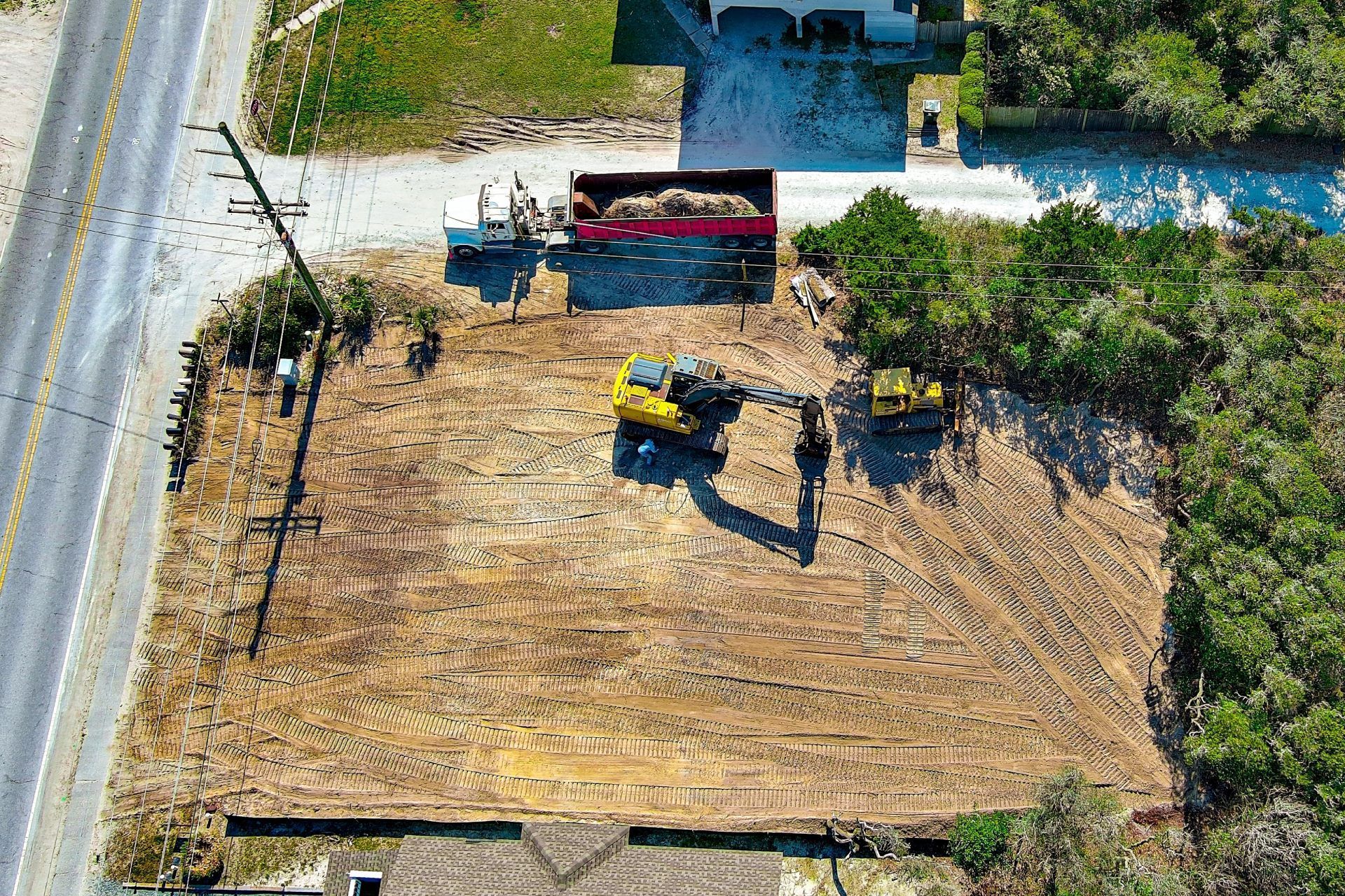
Earthwork, Stockpile Volumes & As-Built Comparison
1. Orthomosaic Maps
- High-resolution, georeferenced site maps
- GCP-aligned accuracy
- Repeatable capture for timeline comparison
- Layered exports (GeoTIFF, PDF, JPEG)
- Compatible with Procore, PlanGrid, and Bluebeam
2. 3D Site Models
- Photogrammetric 3D reconstructions
- Elevation models (DSM/DTM)
- Mesh and point cloud outputs
- Fly-through and cross-section views
- Stakeholder-ready visual models
3. Volumetric & Earthwork Calculations
- Cut/fill measurements
- Stockpile volume tracking
- Grade verification
- Progress-over-time comparison
- Exportable data for engineering teams
4. Progress Mapping Series
Captured weekly, bi-weekly, or monthly:
- Site-wide progress overlays
- Plan-vs-actual comparisons
- Grading and excavation tracking
- Structural and civil milestones
- Cloud-based access for entire team
5. As-Built & Closeout Mapping
- Final site condition documentation
- Georeferenced as-built maps
- Warranty baseline records
- Owner turnover packages
Platform Exports (Civil 3D, Procore)
1. Project Scoping
We coordinate with your PM or superintendent to define:
- Areas of interest
- Required accuracy (GCP placement)
- Flight frequency
- Deliverable formats
- Integration requirements (DroneDeploy, Pix4D, etc.)
2. On-Site Drone Capture
FAA Part 107–certified pilot performs:
- Systematic grid flights
- GCP-aligned missions
- Oblique and nadir imaging
- Multi-sensor capture (RGB, LiDAR if needed)
- Safety-first operations on active jobsites
3. Processing & Delivery
You receive:
- Processed orthomosaics
- 3D models and elevation surfaces
- Volumetric reports
- Progress comparison maps
- Cloud-based access for your entire team
Service Area — Columbus & Central Ohio
We provide construction drone mapping and 3D modeling for projects in:
- Columbus
- New Albany
- Dublin
- Westerville
- Grove City
- Hilliard
- Delaware
- Marysville
- Lancaster
- Newark
- And all surrounding Central Ohio markets

Use Cases
01
Pre-Construction
- Existing conditions mapping
- Topographic baseline surveys
- Site logistics and access planning
- Environmental documentation
02
Earthwork & Site Prep
- Cut/fill volume tracking
- Grade verification
- Excavation progress
- Material staging visibility
03
Vertical Construction
- Structural milestone mapping
- Plan-vs-actual site overlays
- Coordination with civil and MEP
- Progress documentation for owners
04
Closeout
- As-built mapping
- Final condition documentation
- Warranty records
- Owner turnover packages
Why GCs Choose ARO Aerial
- 6+ years of construction-focused mapping experience
- GCP-aligned, survey-grade accuracy
- Engineering-ready deliverables
- FAA Part 107 certified
- Fully insured
- Fast turnaround
- Clear communication with PMs and supers
- Trusted by GCs, CMs, and developers across Ohio
Frequently Asked Questions
What is construction drone mapping?
Construction drone mapping uses UAVs equipped with high-resolution cameras and sensors to capture aerial data and generate georeferenced orthomosaic maps, 3D models, and volumetric calculations for jobsite documentation and decision-making.
How accurate is drone mapping for construction?
With ground control points (GCPs) and professional-grade sensors, construction drone mapping achieves sub-inch horizontal accuracy — comparable to traditional survey methods but delivered faster and at lower cost.
What do construction teams receive from drone mapping?
Teams receive orthomosaic maps, 3D site models, elevation surfaces, volumetric reports, progress comparison maps, and cloud-based access for stakeholders.
Why is drone mapping important for construction?
It improves site visibility, reduces rework, supports RFIs and change orders, verifies earthwork quantities, and provides defensible documentation for owners, investors, and regulatory compliance.
Get Started with ARO Aerial
Need construction-grade drone mapping and 3D modeling for your project?
ARO Aerial delivers accurate, repeatable, engineering-ready mapping and modeling across Central Ohio.
