Adrian O'Dell • April 14, 2026
Construction Progress Documentation with LiDAR & 3D Modeling
FAA Part 107
MBE Certified
EDGE Certified
OSHA 10 Trained
L1 Thermographer
Why Accurate Progress Documentation Matters
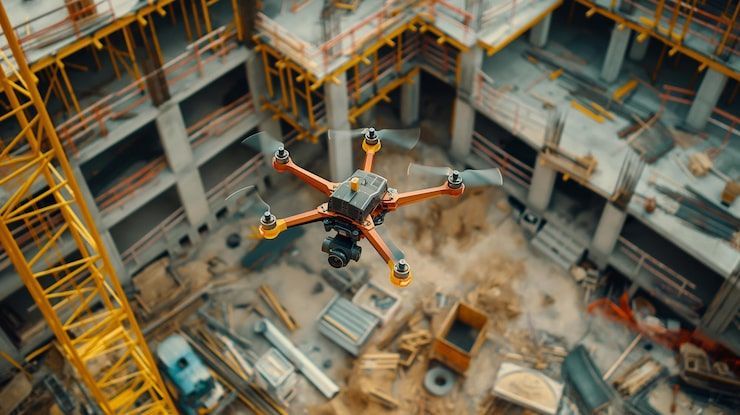
Modern construction moves fast — and so do the expectations. General contractors, civil engineering firms, developers, and industrial project managers all need accurate, defensible, and timely documentation to keep projects on schedule, reduce rework, and maintain transparency with stakeholders.
Traditional ground‑based photos simply can’t keep up.
That’s where LiDAR, photogrammetry, and 3D modeling redefine what “progress documentation” means.
ARO Aerial delivers precision‑grade aerial data that gives your team a complete, measurable, and verifiable record of every phase of construction — from site prep to turnover.
📡 What LiDAR & 3D Modeling Capture
1. High‑Accuracy LiDAR Scans
LiDAR provides dense, survey‑grade point clouds ideal for:
- Earthwork tracking
- Cut/fill analysis
- Pre‑ and post‑grading verification
- Structural progress measurement
- As‑built comparisons
Typical deliverables:
- Classified point clouds
- Digital terrain models (DTM)
- Digital surface models (DSM)
- Contours
- Volume reports
Why GCs and civil firms rely on it:
LiDAR penetrates vegetation, captures complex geometry, and maintains accuracy even in low‑texture environments where photogrammetry struggles.
2. Orthomosaic Mapping (High‑Resolution 2D)
Orthomosaics provide a true‑to‑scale, georeferenced top‑down view of the entire site.
Use cases:
- Weekly/monthly progress tracking
- Site logistics planning
- Material staging verification
- Safety compliance documentation
- RFI support
Deliverables:
- GeoTIFF orthomosaics
- Web‑based interactive maps
- CAD‑ready exports
3. 3D Modeling & Digital Twins
Photogrammetry‑based 3D models and LiDAR‑enhanced meshes give stakeholders a fully navigable digital representation of the site.
Applications:
- Clash detection support
- Structural progress visualization
- Owner updates
- Pre‑bid walkthroughs
- As‑built documentation
Deliverables:
- Textured 3D meshes
- Point clouds
- BIM‑aligned exports (RVT, IFC, OBJ)
🛠️ The ARO Aerial Workflow
Step 1 — Pre‑Flight Planning
- Review site boundaries
- Confirm airspace and safety requirements
- Establish GCP/RTK workflow
- Coordinate with site superintendent
Step 2 — Data Capture
- LiDAR flight for terrain + structure
- Photogrammetry flight for orthos + 3D
- Oblique imagery for vertical surfaces
- Ground control validation
Step 3 — Processing & QA/QC
- Point cloud classification
- Accuracy checks (RMSE, GSD, point density)
- Mesh reconstruction
- Orthomosaic stitching
- Metadata + coordinate system validation
Step 4 — Deliverables & Reporting
- Web‑based viewer for stakeholders
- CAD/BIM‑ready files
- Progress comparison reports
- Cut/fill + volume calculations
- Safety + compliance documentation
🧩 How GCs, Civil Firms & Developers Use the Data
General Contractors
- Weekly progress verification
- Subcontractor accountability
- RFI/CO documentation
- Owner communication
Civil Engineering Firms
- Pre‑grading and post‑grading validation
- Earthwork calculations
- Drainage + utility planning
- As‑built verification
Surveying Firms
- Supplemental aerial data
- Hard‑to‑access terrain mapping
- LiDAR‑supported topographic surveys
Solar & Industrial Construction
- Panel alignment verification
- Site layout optimization
- Structural progress tracking
- Thermal inspections (PV performance)
🧱 Why Choose ARO Aerial
Technical Precision
RTK/PPK workflows, survey‑grade LiDAR, and rigorous QA/QC ensure accuracy you can trust.
Construction‑Ready Deliverables
Everything we produce is formatted for GCs, civil engineers, surveyors, and project managers — not just marketing teams.
Premium, Consultative Support
We don’t just deliver files.
We help you interpret them, integrate them, and use them to make better decisions.
❓ FAQ
How accurate is LiDAR for construction?
Depending on sensor + workflow, LiDAR typically achieves 2–5 cm vertical accuracy, ideal for earthwork and as‑built verification.
How often should progress documentation be captured?
Most GCs prefer weekly or bi‑weekly, while civil firms often request phase‑based captures.
Can aerial data integrate with BIM?
Yes — we provide IFC, OBJ, LAS, and RVT‑compatible exports for seamless BIM alignment.
Do you provide volume calculations?
Absolutely. Cut/fill, stockpile volumes, and material movement reports are standard deliverables.