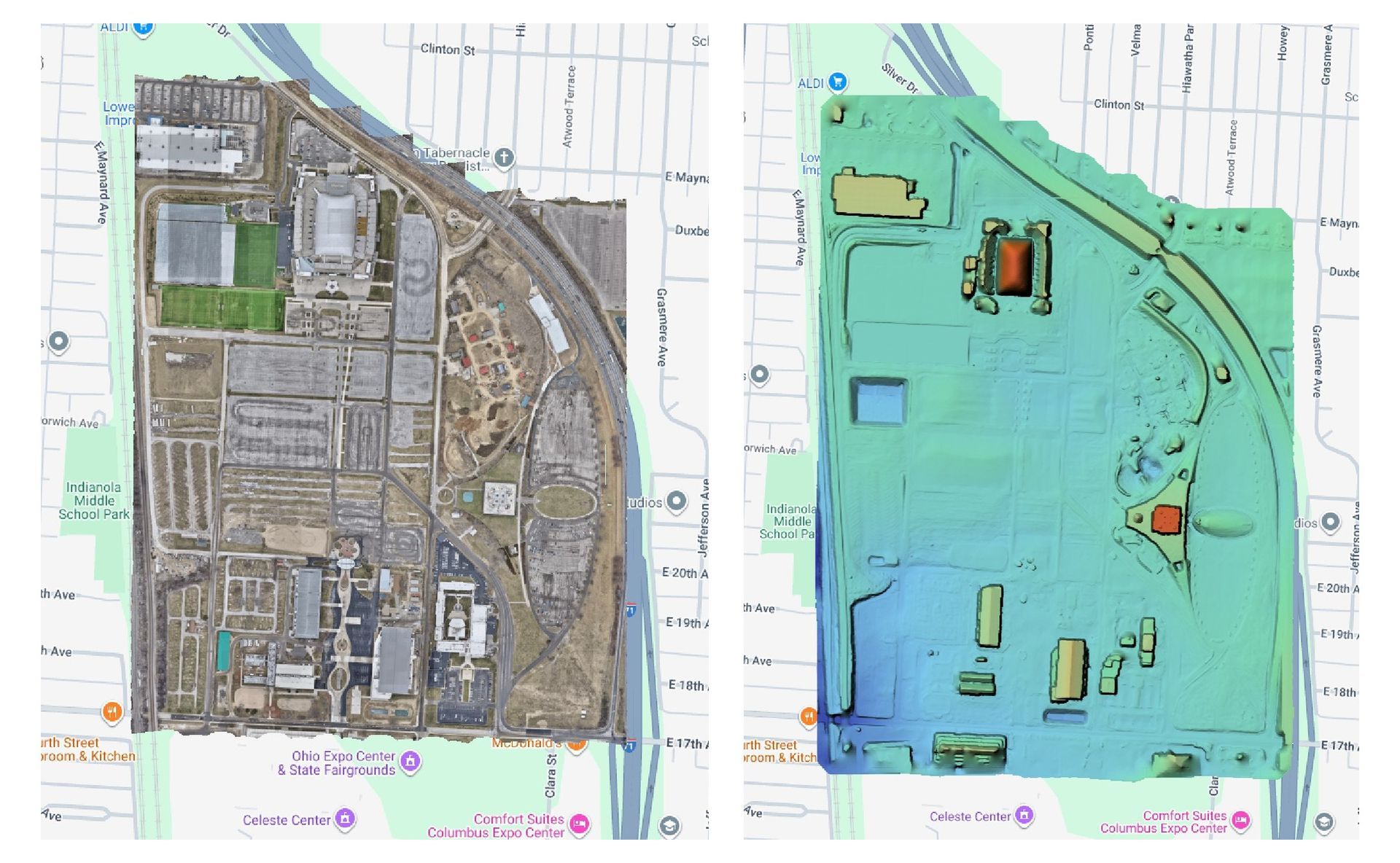
Short answer: Drone LiDAR measures the ground with laser pulses, and some of those pulses reach the ground through gaps in trees and brush. That makes it the right tool when you need bare-earth topo on wooded, overgrown or uneven sites. We deliver a classified point cloud, a bare-earth surface, contours, an orthomosaic and a QA/QC report, tied to your surveyor's control. Pricing is $140 per acre with a $3,500 minimum, and the final package is delivered in 8 business days.
This guide explains how drone LiDAR works, when it beats photo mapping, what you get, how we process it, how accuracy is reported, and how it fits with your surveyor and your design team. ARO Aerial is based in Columbus and flies across Central Ohio. LiDAR processing is done in-house, and owner-pilot Adrian O'Dell flies every job.
How drone LiDAR works
A LiDAR sensor on the drone fires laser pulses at the ground, very fast, as the drone flies a set pattern. The sensor times how long each pulse takes to come back. Combined with the drone's RTK position and orientation, that time becomes a 3D point with a known location and elevation.
Multiple returns
One pulse does not always hit one thing. Over open ground it hits the surface and comes straight back. Over trees, part of the pulse hits the top of the canopy, part hits branches lower down, and some of it slips through gaps and reaches the ground. The sensor records several of these returns from a single pulse.
- First return: usually the highest thing the pulse hit, such as the canopy, a roof or a wire.
- Last return: usually the lowest thing, which under trees is often the ground.
Classification
The raw result is millions of points with no labels. Classification sorts them into groups such as ground, vegetation, buildings and noise, using the standard ASPRS classes. Once the ground points are separated out, we can build a bare-earth surface: the shape of the land with the trees, brush and structures removed. That bare-earth surface is what civil design starts from.
When drone LiDAR beats photo mapping
Photo mapping builds 3D data from photos, so it only sees what the camera sees. Under a tree canopy, it sees leaves. LiDAR is the better choice when:
- The ground you need is under trees or brush, such as creek corridors, wooded lots and park land.
- You need power lines or other thin objects in the data.
- The deliverable is a bare-earth topo surface and contours for design.
Photo mapping is usually the better fit for open ground, paving and active construction, where it also gives a sharper orthomosaic and textured model. For stockpile and earthwork volumes on open ground, either works. Our guide to drone mapping and 3D models covers photo mapping in detail.
LiDAR vs photogrammetry, in short
LiDAR measures distance directly with light and can record the ground under vegetation. Photogrammetry calculates 3D shape from overlapping photos and produces rich color and texture, but needs a clear view of the surface. LiDAR is the tool for bare earth under cover. Photogrammetry is the tool for visual detail on open sites. Many jobs use both, and our LiDAR package includes an orthomosaic. A full LiDAR vs photogrammetry comparison is coming in a separate post.
What you get from a LiDAR drone survey
- Classified point cloud (LAS 1.4, ASPRS classes): The full 3D record, sorted into ground, vegetation, buildings and more.
- Bare-earth surface (GeoTIFF, plus Civil 3D surface / LandXML): Ground model for grading, drainage and design.
- Contours (1-ft intermediate / 5-ft index, DWG / SHP): CAD and GIS base files.
- Orthomosaic (GeoTIFF): True-scale image of the site for context and overlays.
- Topo exhibit (PDF): A readable sheet for meetings and review.
- QA/QC report (PDF): How the data was checked, and the measured accuracy where checkpoints were provided.
Point spacing on our standard topo is about 15 mm. That density is what lets the bare-earth surface pick up curbs, swales, banks and small grade changes.
The seven-stage workflow
- Plan and capture. We review the boundary, tree cover, airspace and your surveyor's control, then fly the site with overlapping passes.
- Validate. We check the raw data for coverage gaps and alignment between flight lines before any processing goes further.
- Classify. Points are sorted into ASPRS classes: ground, vegetation, buildings, noise and others.
- Bare-earth surface. The ground class becomes a continuous surface, with breaklines where the site needs them.
- Contours. We generate 1-ft intermediate and 5-ft index contours from the bare-earth surface.
- CAD and GIS. Files are prepared for Civil 3D, ArcGIS and your standards, in your coordinate system.
- QA/QC and delivery. We check the products, compare to checkpoints where provided, write the QA/QC report and deliver the package.
Accuracy: measured and reported
We do not promise an accuracy number before the flight. Accuracy depends on ground cover, control and site conditions. What we commit to is measuring it.
When your surveyor provides checkpoints, we compare the bare-earth surface to those points and report the vertical error as RMSEz under the ASPRS Positional Accuracy Standards. That number is in the QA/QC report, for your site and your capture day.
Our default coordinate system is Ohio State Plane NAD83(2011), US survey feet, with NAVD88 elevations (GEOID18). If your project uses something else, tell us at kickoff and we will deliver in that system.
Working with your surveyor
A drone topographic survey from ARO Aerial is not a licensed survey. ARO Aerial is not a licensed surveying or engineering firm, and our data is not sealed. Your licensed surveyor sets control and checkpoints and seals any survey.
What we add is coverage. A surveyor's crew collects precise points one at a time. We deliver dense data, tied to that control, across the whole site, including wooded areas that are slow and hard to walk. The surveyor's points anchor and check the data, and the LiDAR fills in everything between them. Bring us in early and we will plan the flight around their control.
3D modeling and scan-to-BIM, honestly
"3D model" can mean many things. Here is what we capture and how it gets to a model:
- Exteriors and terrain: drone LiDAR for geometry, and drone photogrammetry with a DJI Zenmuse P1 for color, texture and textured 3D models.
- Interiors: iGUIDE capture for measured floor plans and virtual tours. See construction-grade virtual tours.
- What we do not have: a terrestrial laser scanner. If your project needs ground-based scanning of building interiors, we will say so up front.
- Revit models: we provide BIM-ready deliverables, and Revit modeling is done with our modeling partner. The point cloud can also be brought into Revit or Navisworks directly through ReCap as a reference.
For photo-based 3D models with a hosted viewer, see drone mapping and 3D modeling.
Progress and as-built documentation
LiDAR is not only for pre-design topo. On active sites it documents what changed:
- Earthwork: compare a new surface to the existing-conditions surface to see how much material moved.
- Cut and fill: compare the current surface to the design surface to see where you are high or low.
- Grading verification: check finished grades and drainage paths against plan before final paving or seeding.
Because every flight lands in the same coordinate system, surfaces from different dates line up and can be compared directly. Progress flights can be scheduled to contractor milestones.
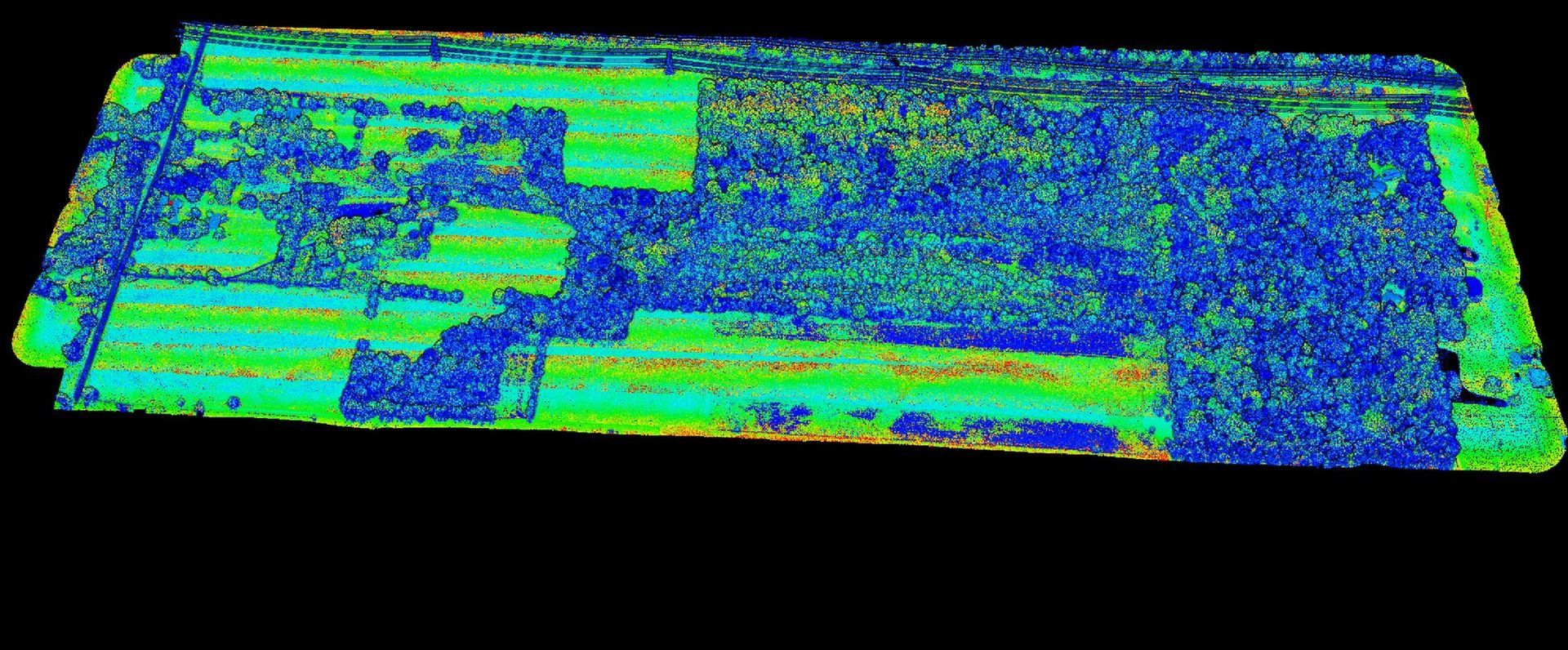
The same point cloud shown two ways. Top: true color from the camera. Bottom: colored by intensity, how strongly each surface reflected the laser, which separates pavement, vegetation and bare ground.
Where drone LiDAR fits
- Civil site design: existing-conditions topo for grading plans, especially on wooded or overgrown parcels.
- Creeks and parks: bank shape and channel ground under canopy, without crews cutting lines through habitat.
- Floodplain and stormwater: bare-earth surfaces for drainage studies, swales and detention areas.
- Corridors: trails, utility routes and roads, quoted per mile.
More for civil teams is on the engineering hub, and for contractors on the construction hub.
Proof from our own work
City of Upper Arlington: Miller Park and Smith Nature Park bridges
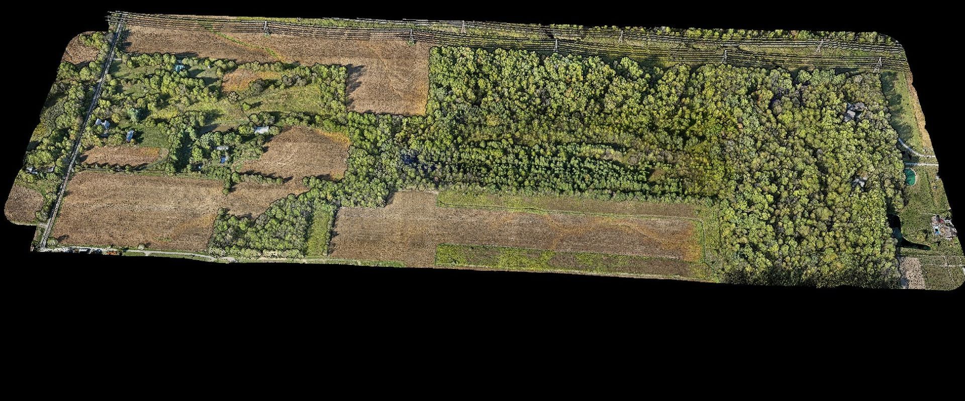
For the City of Upper Arlington, we captured pre-construction terrain for two pedestrian bridge replacements, in Miller Park and Smith Nature Park. Both sit in wooded creek corridors. We flew LiDAR through the canopy along with imagery and delivered a point cloud, a bare-earth DTM, an orthomosaic and condition photos. Progress flights were then matched to the contractor's milestones. No ground crew had to work in the habitat corridor to collect the terrain.
Ballantrae Park, Dublin
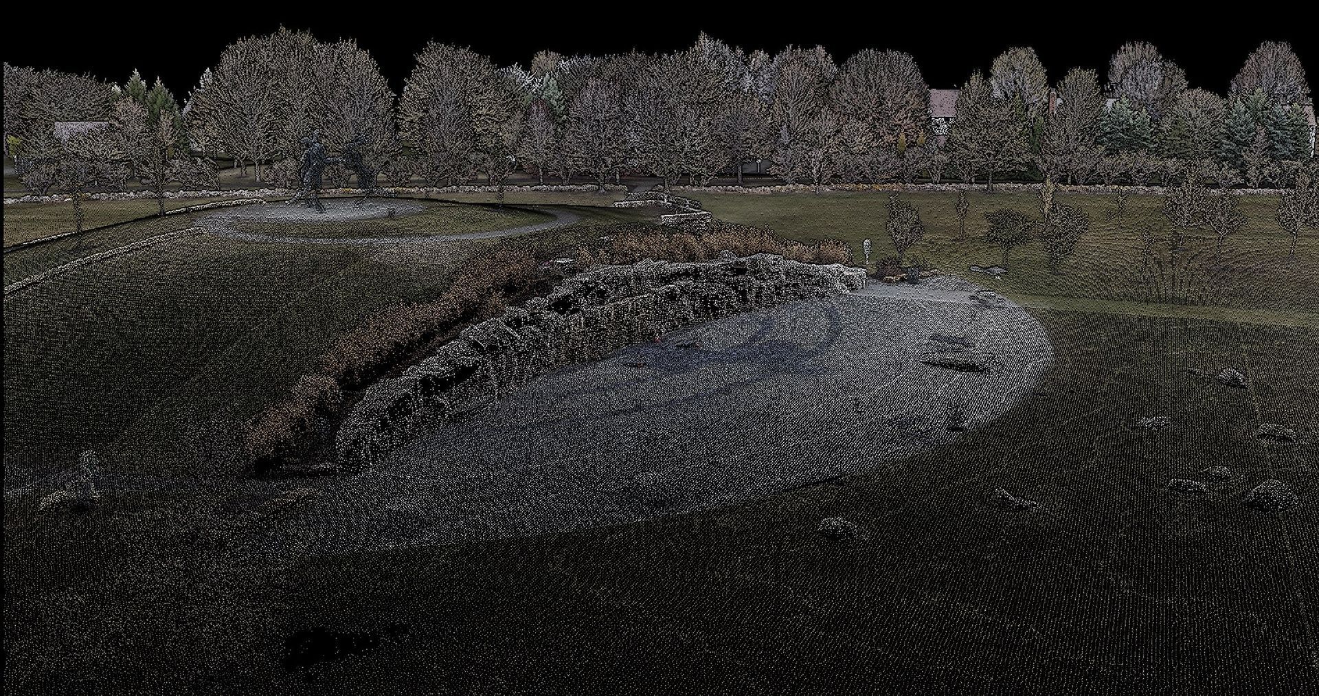
In August 2026 we captured a LiDAR point cloud of Ballantrae Park in Dublin. The image at the top of this guide is from that capture.
Planning a capture: what to send and what affects the result
A good LiDAR job is mostly decided before the drone leaves the ground. These are the things we ask for at scoping:
- Boundary. A KMZ, DWG or marked-up PDF of the area you need, plus any buffer past the property line.
- Purpose. Grading design, drainage study, bridge or trail replacement, earthwork tracking. The purpose decides where breaklines matter most.
- Surveyor and control. Who is setting control and checkpoints, and in what coordinate system. We plan flight lines around their targets.
- Standards. Your CAD template, layer names and preferred file formats.
- Deadline. When design needs the surface, so we can plan capture and the 8-business-day processing window, or rush if needed.
A few site factors change the result:
- Tree cover and season. Leaf-off months let more pulses reach the ground than full summer canopy. Dense evergreen or thick brush means fewer ground points in those areas, and the bare-earth surface there is less detailed.
- Water. Laser pulses do not map the bottom of creeks or ponds well. The water surface and banks are captured; channel bottoms under water usually need your surveyor's shots.
- Weather and airspace. Rain, high wind and controlled airspace near airports affect scheduling. We check airspace and request any needed FAA authorization during planning.
What it costs
Current pricing from our LiDAR services page. The per-acre price covers capture through the final package.
- Topo package: $140 per acre
- Minimum: $3,500 (covers 25 acres)
- Sites over 100 acres: $95 per acre
- Dense vegetation or heavy breaklines: +$30 per acre
- Corridors: Quoted per mile
- Delivery: Final package in 8 business days
Travel within 50 miles of Columbus is included, and rush delivery adds 35%. For open sites where photo mapping is enough, our mapping packages start lower.
Questions
Do I still need a surveyor?
Yes. ARO Aerial is not a licensed surveyor, and our data is not a sealed survey. Your surveyor sets control and checkpoints and seals the survey. We deliver dense LiDAR data tied to that control, and report the measured accuracy against their checkpoints.
Can drone LiDAR see through trees?
Not through solid objects, but through gaps. Some laser pulses pass between leaves and branches and reach the ground, and those last returns become the bare-earth surface. Very dense cover means fewer ground points, and dense vegetation or heavy breaklines add $30 per acre.
What point density do you deliver?
Our standard topo has about 15 mm point spacing. That is dense enough to pick up curbs, swales, banks and small grade breaks in the bare-earth surface.
How long does it take?
The final package is delivered in 8 business days after capture. Rush delivery is available for 35% more. Field time depends on site size and tree cover.
Can you match our CAD standards?
Yes. Tell us your coordinate system, layer standards and file formats at kickoff. We deliver Civil 3D surfaces, LandXML, DWG and SHP contours, and LAS 1.4 point clouds, by default in Ohio State Plane NAD83(2011), US survey feet, NAVD88 (GEOID18).
Should I choose LiDAR or photogrammetry?
If the ground you need is under trees or brush, or you need bare-earth topo for design, choose LiDAR. If the site is open, paved or under active construction, photo mapping usually costs less and gives better visuals. Send us the boundary and we will tell you which fits.
Request a mapping or LiDAR quote. Send the site boundary, tree cover, your surveyor's contact and your deadline, and we will scope the capture. Call (614) 622-8786, email info@aroaerial.com or use our Request a Mapping or LiDAR Quote. Full pricing is on the LiDAR services page.